


Explore, play and learn with ABC Splash. Over 2500 videos, games and other resources. All mapped to the Australian curriculum.


 Your new post is loading...
 Your new post is loading...
Your new post is loading...
 Scoop.it!
Explore, play and learn with ABC Splash. Over 2500 videos, games and other resources. All mapped to the Australian curriculum. 
No comment yet.
Sign up to comment
Scoop.it!
Catherine Smyth's insight:
Although the concepts and content of this website are complex and quite difficult for primary students, the conceptual framework defines and organises spatial concepts.
Scoop.it!
Catherine Smyth's insight:
A short clip to explain geography.
Scoop.it!
Catherine Smyth's insight:
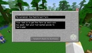
Students enter the exciting world of Minecraft to explore issues relating to Rainforests, deforestation, fair-trade and economics.

Catherine Smyth's curator insight,
October 12, 2014 6:28 PM
Through the exciting world of Minecraft, students explore issues relating to Rainforests, fair-trade, deforestation and economics. Although developed in the UK, the lesson aligns to the Stage 3 Environments strand of HSIE K-6
Scoop.it!

The GA supports primary and secondary geography teachers through teaching resources, geography journals, CPD events, Barnaby Bear, Worldwise and more.
Scoop.it!
This is Richard Byrne's updated list of 20 good online map creation tools for students and teachers. Via R.Conrath, Ed.D.

Maryalice Leister's curator insight,
August 19, 2014 10:18 PM
Teaching geography and maps, then check out these online tools. There will be a perfect one for your needs. Enjoy!
Scoop.it!

Discover ways to take your kids on virtual field trips on-line, exploring the world from your classroom or home!
Scoop.it!

This learning sequence examines the waste management strategies of reducing, reusing, recycling and composting.
Catherine Smyth's insight:
Teaching language and culture through a global issue.
Catherine Smyth's curator insight,
July 21, 2014 12:12 AM
These excellent teaching resources focus on a current issue and help students learn Indonesian at the same time.
Scoop.it!
"Over the course of human history, thousands of languages have developed from what was once a much smaller number. How did we end up with so many? And how do we keep track of them all? Alex Gendler explains how linguists group languages into language families, demonstrating how these linguistic trees give us crucial insights into the past."
Catherine Smyth's insight:
Not really primary geography but so interesting!

Woodstock School's curator insight,
June 4, 2014 6:05 AM
A good teaching tool for explaining the diversity of languages. 
Chris Plummer's curator insight,
January 11, 2015 11:46 PM
Summary- This video explains how so many languages came to be and why. By the early existence of human there was a such smaller variety of languages. Tribes that spoke one language would often split in search of new recourses. Searching tribe would develop in many new different ways than the original tribe. new foods, land, and other elements created a radically different language than the original.
Insight- In unit 3 we study language as a big element of out chapter. One key question in chapter 6 was why are languages distributed the way they are. It is obvious from the video that languages are distributed they way they are is because of the breaking up from people which forced people to develop differently thus creating a different language. As this process continues, there become more and more branches of a language family.
Scoop.it!
Catherine Smyth's insight:
This blog is a treasure chest of ideas and resources for geography in schools.
Scoop.it!

Nicoletta's curator insight,
April 6, 2014 6:21 PM
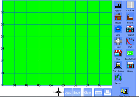
Mapmaker is a simple yet fun educational tool that allows students and teachers to create maps for a range of purposes. This is an effective resource that can assist stage 2 students in consolidating their understanding of the cardinal directions North, South East and West, which is a key feature of outcome ENS2.5 of the HSIE K-6 Syllabus. A compass rose is visible on the map template so students can use this to navigate.
Activity Equipment: Blank map template (either in paper form or on the computer).Optional, interactive whiteboard.Procedure: All students are provided with a blank map template either in paper form or on the computer.The teacher is to inform the students of the starting point on the map.The teacher will then give the students a series of directional instructions, using the geographical terminology of cardinal directions. For example, “Take two steps to the North and one step to the East and there you will locate a school”. Students are then required to place an image of the school in this square of the map. Next, “take one step to the west and two steps to the south and there you will place a bus stop”. The teacher will give a series of instructions along the same line as these.After the teacher has completed the instructions, students compare their maps to the teacher’s and see if they were able to come up with the same map.
Reference List:
Board of Studies. (2006). Human Society and Its Environment K-6 Syllabus. NSW: Board of Studies.
Scoop.it!

From
ecogamer

Windmill game where you have to build windmills in strategic locations. Windfall is a windmill game with NIMBYism at the core.
Catherine Smyth's insight:
The windmill game is an interactive game for teaching about renewable energy. It allows students to consider different views and perspectives.
Scoop.it!
Catherine Smyth's insight:
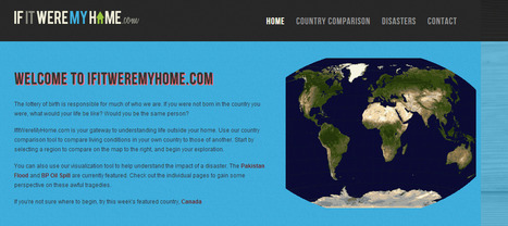
An interactive website comparing countries using a range of different factors.

Regina Chu's curator insight,
April 8, 2014 7:34 PM
Comparison of countries allows students to see different perspectives and lifestyles of children and families all around the world. |
Scoop.it!
Why is Fieldwork Important to Geography? The 3rd of 12 videos from 2011 National Council for Geographic Education President Joseph Kerski.
Scoop.it!

What do kids around the world eat for breakfast? It’s as likely to be coffee or kimchi as it is a sugary cereal.
Scoop.it!
"A great resource full of great links to accompany the Geography Soup channel on Vimeo."
Scoop.it!
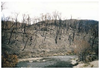
The Geography Teachers Association of Victoria (GTAV) in collaboration with the CFA have produced a 112-page, A4 colour resource - Bushfires: A Geography Resource for Australian students. This publication includes a ...
Scoop.it!
Catherine Smyth's insight:
Classroom ready ideas and resources for teaching primary geography.
Scoop.it!
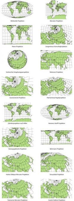
Elizabeth Borneman explores how cartography and cartographic projections help and hinder our perception of the world. "How do you think the world (starting with our perceptions) could change if the map looked differently? What if Australia was on top and the hemispheres switched? By changing how we look at a map we truly can begin to explore and change our assumptions about the world we live in." Geography doesn’t just teach us about the Earth; it provides ways for thinking about the Earth that shapes how we see the world. Maps do the same; they represent a version of reality and that influences how we think about places. Tags: mapping, perspective.

samantha benitez's curator insight,
November 22, 2014 2:53 PM
helps show the different perspectives of our world and how it has changed. also shows many different forms of mapping our world throughout time. 
Emily Coats's curator insight,
May 27, 2015 10:34 AM
UNIT 1 This article discusses map projections and how they shape our perception of the world. Maps influence how we see the world, and could change the way we see it as well. These projections show us many different views of the Earth, which is very influential to our perspectives. This applies to unit 1 and its major concepts and underlying geographical perspective such as analyzing maps.
Scoop.it!

About this document
Scoop.it!
Catherine Smyth's insight:
A really interesting Scoop.It site bringing together history and geography.
Scoop.it!
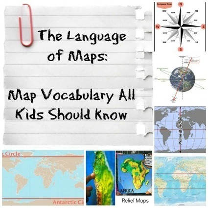
The vocabulary and concepts of maps kids should learn to enhance their map-skills & geography awareness. Concise definitions with clear illustrations. Via Nicoletta
Nicoletta's curator insight,
April 5, 2014 6:13 PM
Global participation, interdependence, cultural diversity and globalisation are all key ideas in the HSIE K-6 Syllabus. Students learning the appropriate skills and terminology to navigate the globe and map is of critical importance to these key ideas and lay an important foundation for Stage 3 and Stage 4 outcomes that expand on this global perspective. Globes and maps assist in connecting students with their own community and importantly with the rest of the world.
This is a comprehensive yet concise blog post explaining the relevant geographical terminology that students should be learning throughout the Primary School years, with particular focus on terminology relating to maps. This blog post covers topics including the equator, the Tropic of Capricorn, Tropic of Cancer and cardinal directions. This geographical terminology is directly linked to the Stage 2 outcome ENS2.5 in the HSIE K-6 Syllabus. As part of this outcome students are required to learn this geographical terminology.
This post is an extremely useful and practical tool for teachers to understand key geographical terminology but it also provides various visual images that would be beneficial to utilise in the classroom. For example, the blog post has included a rotating 3D globe, an image of a compass rose and images of a variety of different map projections.
Reference List:
Board of Studies. (2006). Human Society and Its Environment K-6 Syllabus. NSW: Board of Studies.
Scoop.it!

Sonja Shuttleworth's curator insight,
April 13, 2014 5:21 AM
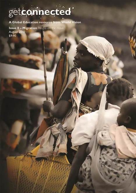
World Vision Australia has a range of school resources linked to its magazine 'Get Connected'. The resources related to migration and asylum seekers are notable for their global perspective.
The migration lesson plan is a series of six lessons designed to accompany the issue of 'Get Connected' focusing on migration. The lesson plan covers the following aspects of migration: - Australia’s immigration story - Push and pull factors - Types of migration - Asylum seekers and refugees - The migrant experience - The role of government and NGOs.
The magazine itself includes a number of personal narratives in the form of written case studies, and the lesson plan links to digital migration stories, part of acmi’s digital storytelling project: http://generator.acmi.net.au/education-themes
MODIFICATION The migration lesson plan does not specify a target stage or age group, and seem to be geared towards upper primary and lower secondary students.
This means that some of the content and activities would need to be modified for Stage 2 students. This could be done by: - limiting the amount of independent research that students are expected to complete for activities - supplying the information instead, either as printouts or links to websites.
Lesson 6, ‘the role of government and NGOs’, may be more suitable for Stage 3 students, who look at ‘structures, roles, responsibilities and decision-making processes of State and federal governments’ (SSS3.8)
However, many of the activities in the lesson plan are already suitable for Stage 2 students. These include: - creating a class graph or chart showing the regions that families come from - making a poster of push-pull factors - examining and interpreting maps.
RESOURCES Although the lesson plan is free to download, the magazine itself is not available to download. It can be ordered from World Vision for $9.90 per copy. http://www.worldvision.com.au/Libraries/School_Resources/Get_Connected_Order_Form_2012.pdf
SUPPLEMENTARY MATERIALS Asylum seekers fact sheet http://www.worldvision.com.au/Libraries/School_Resources/Asylum_seekers.pdf
The refugee journey http://www.worldvision.com.au/Libraries/School_Resources/The_refugee_journey.pdf
LINKS TO OTHER SYLLABUS OUTCOMES Stage 2 teachers could consider using texts with personal narratives to link this global perspective on migration to the English syllabus. Suggested texts include:
The Little Refugee, by Anh Do and Suzanne Do, illustrated by Bruce Whatley - Anh Do's story about his family's escape from war-torn Vietnam and his childhood in Australia, told especially for children http://www.allenandunwin.com/default.aspx?page=94&book=9781742378329 http://www.allenandunwin.com/_uploads/BookPdf/TeachersNotes/9781742378329.pdf
Harmony and understanding http://www.blake.com.au/Harmony-and-Understanding-s/773.htm A nonfiction series that fosters understanding, inclusion, tolerance and respect for the multicultural experience. Created in partnership with the Australian Multicultural Foundation
World Vision Australia and the Primary English Teaching Association Australia have also developed a unit of work called ‘Global people’ http://www.globalwords.edu.au/units/Refugees_UPY6_html/documents/GlobalWords_Refugees_UPY6print.pdf
The ‘Global people’ unit of work is based on the following texts: ‘Ziba Came on a Boat’, by Liz Lofthouse, illustrated by Robert Ingpen ‘Mahtab’s Story, by Libby Gleeson ‘Parvana’, by Deborah Ellis ‘Boy Overboard’, by Morris Gleitzman
Scoop.it!

Jessica Kay Price's curator insight,
April 7, 2014 7:59 AM
This video is a great tool to introduce outcome CUS2.4-Describes different viewpoints, ways of living, languages and belief systems in a variety of communities, focusing on; languages spoken within communities, including the original Aboriginal language spoken in the local community area. This video is a great way to provide the students with an understanding of the vast cultural differences within our world and different communities. Although focusing on a global level is approached in stage 3, I feel that this video does a fantastic job at scaling down the statistics to a small community, which is what we are focusing on in stage 2.
When using this video as a resource, it would be a great idea to play it to the students and engage them in a guided discussion, asking appropriate questions; Were there any statistics that shocked you? Did you think that the 8 languages they addressed would be the most common? Once the students have an understanding of the amount of languages used and have addressed any questions the students have asked, the students can then locate, record, organize and classify language statics in our local community through the CENCUS website. In pairs the students can then find out how many languages there are in their community then scale them to most common to least. Once the class is aware of the diversity of languages in their community, the students can continue working in pair and answer some questions about the different languages to report back and share their findings with the the class e.g. How many Chinese people are there in our community? How many Chinese people speak Cantonese? How many Chinese people speak mandarin? How many people speak 2 languages?
This resource and activity would be great to use worldwide to make comparisons of the different languages used in different countries. It would be also fantastic to use in rural Australia where the primary language spoken is English, the students could get language statistics of different communities and compare it to their own.
|












In Year 4, students learn about the importance of environments to animals and people, and different views on how they can be protected. This video focuses on the Australian Alps and the endangered species that live there.