Coastal management and restoration of our planet's coastlines with a particular focus on California, Louisiana and the Pacific. Emphasizing wetland restoration, aspects of agriculture in the coastal plain, fisheries, dealing with coastal hazards, and effective governance.
As climate change melts sea ice and opens the Arctic Ocean to more shipping and oil exploration, marine mammals and native people in small boats are at risk.
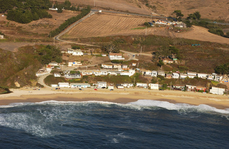
South of Half Moon Bay, billionaire venture capitalist Vinod Khosla is fighting the California Coastal Commission and the Surfrider Foundation, an environmental group, over a half-mile road that snakes across his 53-acre rural property. The road is the only dry land access from Highway 1 to what's known as Martins Beach. Since the 1920s, people have walked or driven it to the beach to fish, surf and swim. The previous owners even did a little business with the beachgoers, charging for parking, running a convenience store near the shoreline and maintaining restrooms.
Everyone loves Kelly Slater. Everyone loves Will Ferrell. And everyone loves Robert Redford, especially your Mom. Ol' Sundance is trying to reconnect the
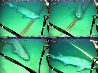
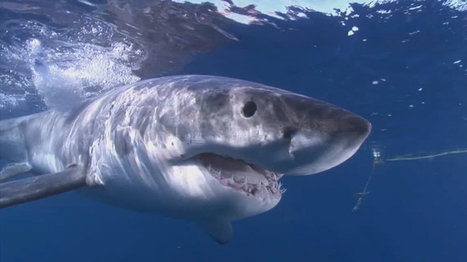
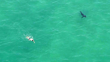
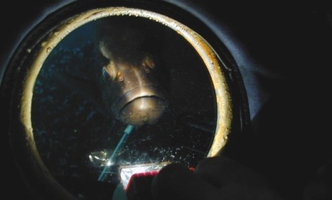
According to a Google engineer, the company has to wrap its undersea fiber optics cable in kevlar to protect them against shark attacks.
PIRatE Lab's insight:
Hmmm...this is probably nothing more than the elasmobranchs sensing some corrosion or general signal traffic electromagnetic fields. Interesting in any event.
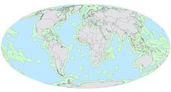
You have probably heard that wild fish are in peril around the world, and that in some places their populations are in precipitous decline. That is particularly true on the high seas, or international waters. Operating as a massive unregulated global commons, where any nation can take as much as it ...
PIRatE Lab's insight:
Ending overfishing is complicated business. In this recent article from UCSB researchers, one option to solving the messy tragedy of the commons that is high seas fisheries is to simply close the whole thing down.
They’re not alone in taking seriously this blunt force approach (at least on paper); Palau is considering a ban on all commercial fishing in its waters.
Not everyone is ready to give up the incremental approach though. Daniel Pauly thinks that success in developed world fisheries could be replicated to protect the fisheries of the global South. To do so effectively requires counting local fishermen’s catch though; no small feat in the developing world.
Our Coast Our Future provides San Francisco Bay Area managers and planners with sea level rise and storm surge scenarios. Learn more.
PIRatE Lab's insight:
Online Flood Map for Sea Level Rise and Storms Now Available for San Francisco Bay
‘Our Coast, Our Future’ provides the most up-to-date science and planning tools to help understand, visualize, and anticipate impacts from sea level rise and storms.
Our Coast, Our Future is pleased to announce the addition of San Francisco Bay to our online planning resources.Our Coast, Our Future provides Bay Area coastal managers and planners with a locally relevant, online map and associated data and tools to help understand, visualize, and anticipate vulnerabilities to sea level rise and storms over the next century and beyond. Questions related to restoration, climate adaptation, natural resource management, municipal, and infrastructure maintenance plans can all be addressed using the localized projections easily accessed through our website.
The addition of San Francisco Bay is timely, as NOAA just named San Francisco one of the Nation’s top 10 cities experiencing increased nuisance flooding caused by sea level rise. With this addition, a powerful suite of planning resources now exists for the 9-county Bay Area including:
An interactive, online flood map tailored to priority planning needs throughout the Bay Area;A seamless Digital Elevation Model (DEM) at two meter horizontal resolution;A combination of 40 different sea level rise and storm projections, using the USGS Coastal Storm Modeling System (CoSMoS), that incorporates present and future tides and storms (e.g., storm surge and waves), as well as river discharge, vertical land motion, wind waves, and existing levees for San Francisco Bay; andA “King Tide Scenario” for San Francisco Bay, or visualization of annual high tides that occur when the gravitational pull of the sun and the moon is in alignment. Photos taken as part of the California King Tides Project are available through the map, depicting local areas experiencing flooding from the highest high tides of today, which will be the average water levels of the future.
Many local agencies are already utilizing the Our Coast, Our Future data and tools. Marin County is partnering with the project to conduct the vulnerability assessment portion of their Local Coastal Plan update. The San Francisco Bay National Estuarine Research Reserve is using the data to begin examining potential economic impacts of road mitigation options in a portion of China Camp State Park. Santa Clara County is incorporating the data into their own county-wide adaptation planning tool, Silicon Valley 2.0.
The following training and technical assistance opportunities are available to planners and mangers in the Bay Area:
August 27th and September 3rd - Two demonstration webinars (same content) hosted by the Bay Area Climate and Resiliency Project from 10:00 – 11:00 a.m. These will include background on the model, a live demo of the online flood map, and extended Q&A. To RSVP, email Bruce Riordan, bruce@bayareajpc.net.In-person staff trainings for planning and management agencies. The project team has availability September – October 2014. To schedule a training, contact Kelley Higgason, kelley.higgason@noaa.gov.
TakePart SeaWorld to expand killer whale habitat at its parks Orlando Sentinel Debate about the company's treatment of the whales was brought into the mainstream press by the 2013 documentary "Blackfish." The project is "not a concession" to...
A good video that is difficult to watch with a straight face. When SeaWorld says this massive, multimillion dollar investment is not in reaction to the film Blackfish or animal rights activists...well, you should just watch it.
San Diego will be the first park to have its whale enclosure expanded. There is also increasing pressure to find a "cove" or "embayment" wherein captive Orcas can be "retired" rather than set free in a world they know nothing about.
Additional coverage and perspectives can be found here:
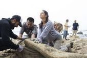
Volunteers chop up a reeking whale carcass to salvage bones as vital learning tools for underprivileged Bay Area students If there's anything as enjoyable to Dan Sudran as sawing through the stinking blubber of a whale carcass and extracting bones from the gooey tissues, it would be showing the results to children. Sudran, the founder and director of the nonprofit educational group Mission Science Workshop, led a team of about 20 volunteers Friday in the salvage of a 25-foot long humpback whale that had washed ashore next to the Pigeon Point Lighthouse. "There was a lot of evidence that it was attacked and killed by orcas," said Sue Pemberton, curatorial assistant in the department of ornithology and mammalogy at the California Academy, which is a member of the Marine Mammal Stranding Network. "Mmmm, peanut butter and jelly," cracked another to Westberry, who plans to extract oil from the fat and use it for chemistry lessons on combustion, light and heat, which is what whale blubber was historically used for. Sudran said humpback skeletons are especially fascinating because it is clear when they are examined that the species was once a land animal, with legs, arms and hands, the remnants of which are particularly evident in the flipper bones.
PIRatE Lab's insight:
Ahh...the stench of a rotting marine mammal. Good times.
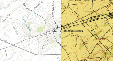
"This cool new historic mapping app from the folks at esri and the U.S. Geological Survey is worth exploring. What it does is take 100 years of USGS maps and lets you overlay them for just about any location in the nation. That allows users to see how a city – say Harrisburg – developed between 1895 and today. The library behind the project includes more than 178,000 maps dating from 1884 to 2006."
PIRatE Lab's insight:
For more ESRI maps that let you explore urban environmental change, the 'spyglass' feature gives these gorgeous vintage maps a modern facelift (but not available for as many places). The cities that are in this set of interactive maps are:
Chicago (1868)Denver (1879) Los Angeles (1880)Washington D.C.(1851)New York City (1836)San Francisco (1859)
Ocean temperatures along the Central California coast experienced a "remarkable" warming period during the first three weeks of July, leading to unusual encounters with some fish species, scientists reported.
PIRatE Lab's insight:
This is part of the reason we are seeing unusual Opah catches, etc. The water in early July on the beaches in San Diego during some of our surveys seems actually hot.
Mitch Ridder’s Laguna Bluebelt received the most number of on-line votes and is our Viewers’ Choice winner. This photo was taken in Laguna Beach when a winter storm rolled in off the ocean as the tower of Hotel Laguna was lit in the foreground.
PIRatE Lab's insight:
Click around to see the winners and all the entries in this year's California Coast amateur photographer contest. As always, there are tons of great images here.
Tighter bag limits for fishermen have been identified as an important key to ocean ecosystem conservation.
PIRatE Lab's insight:
The story here seems to be that we can't simply let a system go with only a single management approach in one subsection of there overall region/ecosystem.
We're coming up on California's real summer, so what better time to explore some uncharted coastal territory?
PIRatE Lab's insight:
As always with such lists, many of the entrants can't really be called "under-the-radar." But nonetheless, there are several classic California beach towns here.
"Similarly to all living things, [marine animals] are dynamic, mobile, and fundamentally have the same motion properties as us,” photographer Daniel Stoupin says. “They grow, reproduce, spread, move towards sources of energy, and away from unfavorable conditions. However, their speeds happen to be out of sync with our narrow perception.” Watching them with a little help from time lapse photography is a reminder of how beautiful slow life can be.
PIRatE Lab's insight:
Beautiful slow-mo, close magnification, UV-lit denizens of shallow reefs. Mostly corals, but there are also some tunicates and sabellids here. I particularly like what seems to be a Fungia (solitary coral) erupt from under some coarse coral rubble.
SCOTLAND, UK - Protect Wild Scotland has filed complaints with Trading Standards and the Competition and Markets Authority regarding farmed Norwegian salmon being sold as wild Scottish salmon.
David Miliband, Co-chair of the Global Ocean Commission, tells the story of the Commission's inquiry into high seas governance and ocean health, and outlines...
PIRatE Lab's insight:
The Global Ocean Commission is an independent organization of senior politicians formed to develop feasible solutions for key issues facing the high seas. In June they released the results of their 18-month study into the state of the high seas. Their big takeaway: many of the problems facing the high seas are due to a lack of adequate governance, leading to a maritime Wild West with little enforcement of the few existing laws.
As David Miliband, a former British foreign secretary and a co-chair of the commission,told Reuters, "a previously virgin area has been turned into a plundered part of the planet."Even Sigourney Weaver has lent her voice to the cause, urging the UN to "tame the High Seas 'Wild West.'"This illustrated video explains what the commission found, and why they think urgent action is necessary now.
The Commission put forth several potential solutions, with a deadline of 5 years. Here’s our quick summary of what they want the world to do:
Develop a UN Sustainable Development Goal for the oceansUpdate the Law of the SeaPhase out fuel subsidies for high seas fishingBan transfers of fish from ship to ship at seaMinimize single-use plasticsCreate an international convention to help monitor and regulate offshore oil and gas explorationCreate an independent global accountability board
Finally, this massive plan includes a *nuclear option*. If the high seas continue to decline 5 years after adopting the plan, the entirety of the high seas (with some exceptions) should become a regenerative zone closed to all industrial fishing.
Any student currently enrolled full-time at an academic institution in the USA and who meets the specific criteria for one of the types of grants listed to the left. The funded activity (conference, research, course) may take place anywhere, including non-USA locations, and international students are eligible IF they are attending a university in the USA.
PIRatE Lab's insight:
Money for Travel, Research, and/or field courses (e.g. New Orleans).
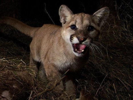
Unmanned aerial vehicles (UAVs), known colloquially as drones, don’t offer just a safer way for scientists to observe their subjects; they’re often less costly, more efficient, and more precise than traditional approaches. As Junda can attest, biologists are still navigating the challenges and complexities of mixing wildlife and drones, working to improve maneuverability, autonomy, and endurance—and hitting regulatory hurdles. Learning curve aside, the technology holds incredible potential. “Drones are going to change the way that data is collected,” says Leanne Hanson, a U.S. Geological Survey biologist who has used them to count migrating Sandhill Cranes.
A US firm has started work on huge floating cages that will hold 1,000 tonnes of fish in the deep sea off Hawaii’s coast.
Hawaii Oceanic Technology Inc. (HOTI) has received permits to build 12 cages, which it calls “Oceanospheres“, in a 247-acre area off the coast of Hawaii, which it has leased out.
The floating fish farms will be 180 feet wide cages submerged at a depth of 20 metres. The farms will raise tuna fish from egg to harvest size in a self-contained system. The company hopes to harvest fish within 18 months.
“Our goal is to develop a new, environmentally responsible way to raise tuna in deep waters,” Bill Spencer, CEO of HOTI was quoted as saying in media reports.
HOTI hopes to cash in on ocean fish farming which is estimated to be a US$75 (€56.033) billion market by 2020, West Hawaii Today reported.
For some, the irony is almost too much to bear. While Congress is eager to fund a $2 billion expedition to search for oceans beneath Europa, some 95% of Earth's oceans are unexplored. Given the role of oceans in regulating climate, and their untapped potential for food and health, is it time to rethink our priorities?
PIRatE Lab's insight:
I am never too comfortable when we start saying we need to fund scientific endeavor #2 rather than endeavor #1. Such things often seem to devolve into a popularity contest with exploration and discovery marginalized in a sea of pandering or self-serving assertions.
But there are certainly some well made points here by Mark Strauss, playing off of the arguments proffered by Michael Conathan a few months back. Give it a run through.
To get content containing either thought or leadership enter:
To get content containing both thought and leadership enter:
To get content containing the expression thought leadership enter:
You can enter several keywords and you can refine them whenever you want. Our suggestion engine uses more signals but entering a few keywords here will rapidly give you great content to curate.


 Your new post is loading...