

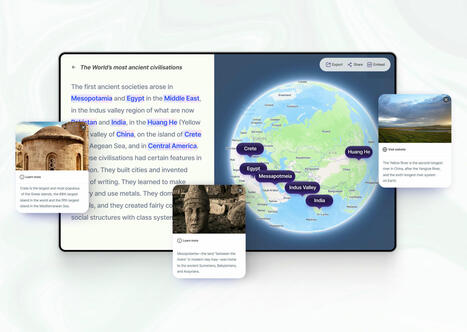

Comment créer une carte interactive à partir d'un texte ? Textomap est un petit utilitaire en ligne pour détecter des lieux et adresses dans un texte.
Via Fidel NAVAMUEL
Get Started for FREE
Sign up with Facebook Sign up with X
I don't have a Facebook or a X account


 Your new post is loading...
 Your new post is loading...
Your new post is loading...
Comment créer une carte interactive à partir d'un texte ? Textomap est un petit utilitaire en ligne pour détecter des lieux et adresses dans un texte. Via Fidel NAVAMUEL 
No comment yet.
Sign up to comment
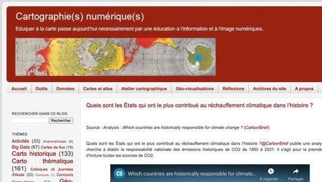
Cartographie(s) numérique(s) est un site de prof et un blog de référence en matière de cartographie et d'information géographique à l'heure du numérique. Via Fidel NAVAMUEL
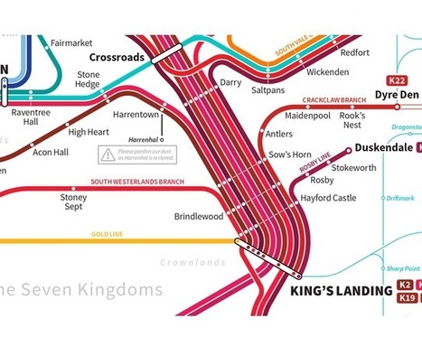
Getting around Westeros often lea Getting around Westeros often leads to trouble, but what if there was a subway? Designer Michael Tyznik has imagined just such a scenario, and put together a fictional rail map of the fictional kingdom from the Game of Thrones series that will take you from the Shadow Tower to King's Landing with just one transfer station. If only it were so simple — but then George R.R. Martin's books would have been more like a food blog. s to trouble, but what if there was a subway? Designer Michael Tyznik has imagined just such a scenario, and put together a fictional rail map of the fictional... Via René Z., association concert urbain, Rui Guimarães Lima
|
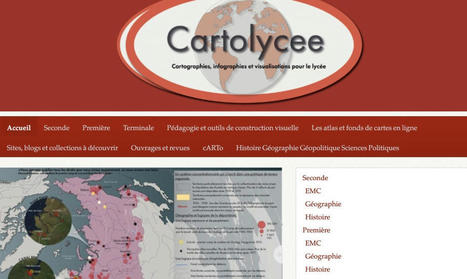
Où trouver des cartes et des infographies adaptées aux programmes ? Voici une sélection de sites de confiance. Bienvenue dans l’univers des passionnés de cartographie. Via Fidel NAVAMUEL
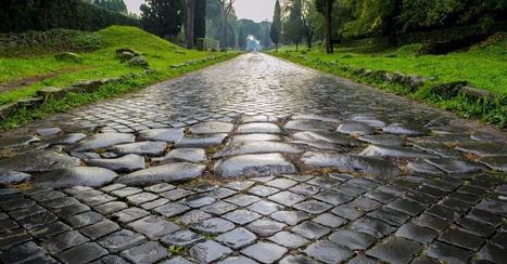
Orbis est un outil cartographique étonnant.Il s'agit d'une sorte de Google Maps de l'époque antique qui gère toutes les routes de l'empire romain.
|


