URBANmedias
76.1K views | +0 today
Follow
URBANmedias
le mediation des aménagements urbains
Your new post is loading...
Rescooped by association concert urbain from green streets
November 15, 2012 9:27 AM
Scoop.it!

A Mass-Transit Proposal To Connect A City Using Aerial Gondolas

A Mass-Transit Proposal To Connect A City Using Aerial Gondolas | URBANmedias | Scoop.it


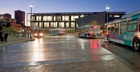
For many, aerial mass transit--either by way of tram or gondola--is an idea best left to ski resorts and World’s Fairs.


 But for a growing number of urban planners and designers, aerial transit represents an alternative for cities where traditional transit options are limited. At PSFK’s recent conference in San Francisco, Frog Principal Designer Michael McDaniel unveiled an ambitious plan called the Wire, which proposes a network of gondolas over Austin, Texas.

McDaniel and his team imagine a system of detachable gondolas connecting neighborhoods throughout the city, making it possible for cyclists and pedestrians to “hop” over particularly congested areas. “The big advantage here is the detachable part which means more gondolas can be added during rush hour and removed in non-peaks times,” he tells Co.Design.

After looking at precedents--like dedicated bus lanes and Portland, another city whose aerial tram has been a huge success--the design team took to Austin’s streets, interviewing locals about their transit experiences...


Via Lauren Moss
No comment yet.
Rescooped by association concert urbain from green streets
July 25, 2012 3:45 AM
Scoop.it!

Designing Buildings that Evolve with the City

Designing Buildings that Evolve with the City | URBANmedias | Scoop.it

Resilient cities need infrastructure that lasts and planning teams that are willing to step up to the plate. Designing structures that can sustain decades of use requires forethought beyond the basic combination of blocks, steel and glass. Just like sidewalks and street corners, city buildings have the power to connect people to one another. Buildings are shelters from unpredictable weather, places where people can have a good time or sit quietly and think. Buildings can also serve as checkpoints or another step in someone’s journey from point A to B.
Developing cities that thrive through the ebb and flow of time are not simply about creating infrastructure that can persist, but about designing buildings that evolve as cities evolve. Sustainable design transforms as cities develop visions for furthering connections among neighborhoods and city sectors. Design features such as energy efficiency, water conservation, and heat reduction that better regulates a building’s temperature are significant elements that replenish a city’s vitality through buildings that are capable of adapting to a city’s needs. Infrastructure that is greater than the sum of its parts also requires infrastructure that functions according to the changing needs of residents...


Via Lauren Moss
No comment yet.
Rescooped by association concert urbain from visual data
September 8, 2012 10:01 AM
Scoop.it!

Are Our Transit Maps Tricking Us?

Are Our Transit Maps Tricking Us? | URBANmedias | Scoop.it
Subway maps distort the reality on the ground for all kinds of reasons. What happens when we make decisions based on them?

London’s city center takes up about two percent of the city. On the Tube map, it looks four times as big.

Over in New York City, Central Park—which is a skinny sliver, much longer than it is wide—was depicted in some 1960s and ‘70s IRT maps as a fat rectangle on its side.

So public transit maps are distorted, quite on purpose. All of them enlarge city centers. Many use a fixed distance between stations out in the boonies, even if, in reality, they’re spaced wildly differently. Curvy lines are made straight. Transfers are coded with dots, lines, and everything in between.

According to Zhan Guo, an assistant professor of urban planning and transportation policy at NYU Wagner, certain cities allow for more flight of fancy than others. San Francisco and New York have a lot of geographic markers, so passengers will only accept so much map distortion.

New York’s grid system further discourages excessive futzing. In Chicago, the line is elevated, which leaves even less leeway. But in a place like London, with twisty streets, few geographical markers other than the Thames, and an underground system, you can pull a lot more over on people...


Via Lauren Moss
No comment yet.
Rescooped by association concert urbain from green streets
May 31, 2012 1:32 PM
Scoop.it!

Human Transit: Paris: "the bus stop of the future"

Human Transit: Paris: "the bus stop of the future" | URBANmedias | Scoop.it

Now that Paris has bus lanes on almost every boulevard, we can expect their transit agencies to continue investing and innovating around their frequent and popular bus services.


Via Jandira Feijó, Lauren Moss
No comment yet.