


URBANmedias
76.2K views |
+0 today
 Your new post is loading...
 Your new post is loading...
Your new post is loading...

It wasn’t too long ago that the term ‘Smart City’ was not on very many people’s radar screens, but recently, it has been more familiar, and people are understanding the concepts behind smart cities.
A smart city uses information combined with technology to improve quality of life, reduce environmental impact, and decrease energy demand. This list of the smartest cities on the planet takes those factors into consideration, as well as the ‘smart’ plans the city might have for the future... Via Lauren Moss, Toni Sánchez 

Phillip Trotter's curator insight,
February 12, 2013 12:26 PM
Great find from Peter Jasperse's blog and an inspirational read for those interested in building a smarter cities and environments since these cities have already started along the journey.

The National Geographic Education team has produced a fabulous site that has online GIS tools for understanding the environment of the Cheasapeake Bay watershed. Students can upload their data, click on various layers, and use drawing and measuring tools. Other "Fieldscope" projects are available as well at: http://education.nationalgeographic.com/education/program/fieldscope/
|
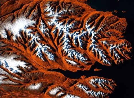
Of all the cosmic bodies studied in the long history of astronomy and space travel, the one that got the least attention was the one that ought to matter most to us—Earth. That changed when NASA created the Landsat program, a series of satellites that would perpetually orbit our planet, looking not out but down. Landsat was built for public monitoring of how the human species was altering the surface of the planet. The space agency, along with the U.S. Geological Survey (USGS), has accumulated a stunning catalog of images that, when riffled through and stitched together, create a high-definition slide show of our rapidly changing Earth, which for the first time date all the way back to 1984.
These Timelapse pictures tell the pretty and not-so-pretty story of a finite planet and how its residents are treating it — razing even as we build, destroying even as we preserve. Visit the article link to see an exclusive timelapse of climate change, deforestation and urban sprawl unfolding as Earth evolves over 30 years... Via Lauren Moss

Ishola Adebayo's comment,
July 31, 2013 9:07 AM
good day Sir, pls need help on fixing scan line errors on lansat7 ETM images from 2003 using for example ArcMap9.3 or ENVI4.5 or.........thank you so much

Courtney Barrowman's curator insight,
May 27, 2015 10:55 AM
summer work KQ2 key concepts: remote sensing, deforestation, desertification, land use, geospatial
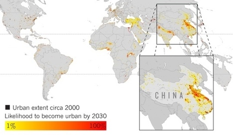
Projections of urban growth indicate areas where biodiversity is at high risk.
The AAG Smart Brief is a fantastic source of geographic news. This is what they said about this article: "Areas such as tropical Africa and eastern China are expected to be hot spots of urbanization during the next several years, according to researchers, who used satellite imagery and other data to project future urban expansion through 2030. 'We're not forecasting population, we're forecasting the expansion of urban space,' said Yale University geographer Karen Seto. Their efforts could be used to assist conservation initiatives, Seto noted."
Tags: AAG, urban, sprawl, land use, urban ecology, biogeography, unit 7 cities, environment. Via Erin Miller

Lauren Fiedler's comment,
July 24, 2013 7:56 AM
This article is about urban growth and decline, Africa and Asia are predicted to be hot spots of urban growth in the next few years. Geographer Karen Seto of Yale University in New Haven has creted a graph that finally accounts for variations in how individual cities occupy their land and the impact they have on local ecosystems.
|


This would be great to teach the power of tornadoes for Science!
En cas de catatrophe naturelle, les sociétés d'imagerie satellitaire mettent à la disposition du public leurs images. Ici deux images sont superposées et un volet permet de constater l'étendue des dégâts. A remarquer le fait que la tornade suit une trajectoire précise épargnant certains lieux tout proches.