

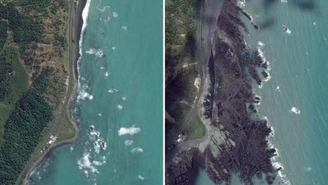
The 7.8 magnitude earthquake that hit New Zealand’s South Island lifted up the seabed by two metres, pushing it above the ocean’s surface.
Via Aki Puustinen
Get Started for FREE
Sign up with Facebook Sign up with X
I don't have a Facebook or a X account


 Your new post is loading...
 Your new post is loading...
Your new post is loading...
The 7.8 magnitude earthquake that hit New Zealand’s South Island lifted up the seabed by two metres, pushing it above the ocean’s surface. Via Aki Puustinen 
No comment yet.
Sign up to comment
|
From
www


Richard Aitchison's curator insight,
March 22, 2018 11:09 AM
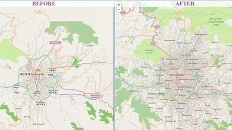
This is a great example of how using technology can benefit people. In Nepal, in which they are an area where they can get many earthquakes, they used "crisis maps" to their advantage. First off as the article state Nepal is a very difficult country to navigate and especially after the earthquake with roads being destroyed it could make it nearly impossible. With people in dire need of supplies they had to get creative. So here they used a software system called "OpenStreetMap." It is, as described in the article, a Wikipedia for mapmakers. Basically, anyone can add to the map from an amateur to a professional map maker. By allowing everyone to help they were able to make more accurate maps and faster ways to reach someone that had a need for supplies, these became the crisis maps that they would use. Going into the future this software will continue to be important in Nepal as you can constantly edit the maps and continue to find better and more efficient ways to get to place to place. Other countries with these issues should look towards Nepal and take preemptive action so that when a disaster does strike they will be ready and will not lose valuable time right after a disaster. A very interesting article in which I did not previously know much about.
|


