With new technologies and an explosion of geodata, more and more agencies are mapping to make sense of their missions.
Maree Whiteley's insight:
'...using maps leads to better decision-making' and so much more, such as critical thinking, visual literacy ...geodata and making sense of our world. Geography is such a critical life skill.
The GTAV is the peak organisation in Victoria, Australia providing support for geographical educators. It offers high quality professional learning programs, produces award-winning resources and keeps its members aware of contemporary issues.
Maree Whiteley's insight:
Fantastic collection of AC Geography resources here for Primary and Secondary teaching and learning...Thanks GTAV!
The purpose of this blog is to provide a resource for teachers interested in engaging with professional learning in geography. This blog aims to be a repository of professional learning activities, presentations, resources and discussions to support the introduction of high quality geographical teaching and learning
Having a sound knowledge of geography skills and tools is essential as well as understanding how to teach them. This Geoaction blog can provide a fantastic launch-pad for teachers wishing to extend their own professional understanding of geography before stepping into the classroom.
Some of the topics/resources accessible through this blog:
-Inquiry Based Learning -Literacy
-Fieldwork
-Integrating Technology/ICT
This blog also has a wealth of links to other primary Geography teaching resources such as scoop.it sites, games, lesson plans as well as other links to further blogs and resource sites.
The introduction of the new Geography K-10 syllabus, combined with the need to meet the requirements as set out in the Australian Professional Standards for Teachers could potentially place a great amount of stress on teachers of all experience levels when it comes to delivering rich and appropriate content for their classroom.
Rae Carlson (2016) notes that a key component of effective teaching is enthusiasm and appreciation of the content form the teacher. A great way to promote this is through confidence in your own knowledge and understanding of the discipline.
Carlson, R. (2016) Lecture Slides - EDMT5534, University of Sydney
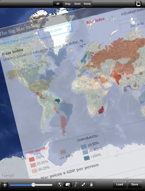
Detailed international and regional statistics on more than 2500 indicators for Economics, Energy, Demographics, Commodities and other topics. Tables, charts, maps free to download, export and share.
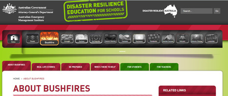
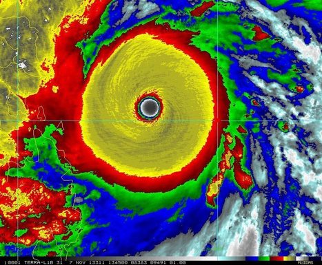
For teachers and students, this toolkit of disaster resilience education resources focuses on both individual and community resilience, vital components to developing a shared understanding of the critical role everyone plays in developing a disaster resilient Australia. Resources are designed to be flexible to individual learning styles and are aligned to curriculum
Maree Whiteley's insight:
Very timely resources in light of current NSW Bushfires...
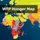
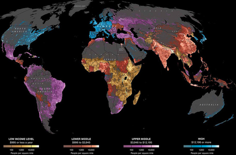
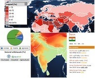
From Africa and Asia to Latin America and the Near East, there are 870 million people in the world who do not get enough food to lead a healthy, productive life.
I really liked this map because it's easy to read and is interactive. This would work really well on the SmartBoard because it's easily accessible for both the students and teacher. This resource could be adapted into a lesson where the students must choose either a red or burgundy country and complete a research project on why these countries have such high levels of hunger. You could also do group presentations on their findings so the whole class gets an overall view of developing countries. The great thing about this map is that it's very basic and can be used in younger grade levels without adjustment.
“Sustainable Food Systems for Food Security and Nutrition” will be the focus of World Food Day in 2013.The official World Food Day theme – announced at the start of every year by the Food and Agriculture Organization of the United Nations (FAO) – gives focus to World Food Day observances and helps increase understanding of problems and solutions in the drive to end hunger.
I'd like to share the RA I've used for my French residential trip (Yr 8, 6 days in France). I think It's quite comprehensive and has been developed and regularly reviewed over the past 8 years. I know it's not easy to get started. Hopefully this document will give you some ideas on what the risks are / who is at risk / what control measures need to be put in place / and if the risk is still high what additional measures you need to think of.
Anne-Laure Fréant talks about the importance of geographic knowledge in today's society. Kirk Goldsberry mentioned in “The Importance of Spatial Thinking” that “Harvard eradicated its Geography Department in the 1940′s, and many universities followed suit”. Indeed, not only has geography never been part of business programs, it gradually vanished from education fields that matter in prestigious schools, with no major revival since the 1940′s.
Maree Whiteley's insight:
Simple logic really..."It is a way of thinking that crosses time and space at any possible scale to see and understand what is happening. It connects the dimensions of the world – societies, environment, economy, politics, finance, psychology… – by offering unique key concepts and theoretical tools."
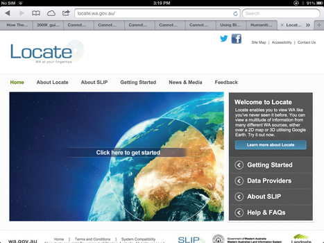
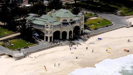
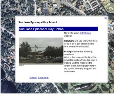
A great way to do a virtual excursion with the classroom. Children can learn about landmarks, directions, the jargon in maps and other aspects of geography.
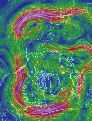
A new map of wind patterns is so visually stunning it's easily mistaken for art. This interactive visualization of wind patterns — modeled from the U.S
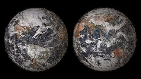
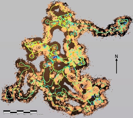
Today marks the start of National Heritage Week – a time to celebrate Australia’s unique and fascinating heritage. We are kicking off the festivities by presenting new 3D data from Fort Lytton, one...
After a year or two of tinkering and experimenting with apps for teaching / learning Geography, I have (finally) compiled this list of what I deem to be the most useful iPad apps for teaching Geogr...
How many apps do students have on their smartphones? How many of them pertain to their school work? I would say none. But these apps are a good way to have students easily look up facts and numbers about poverty, population, economy, culture, etc. A teacher can easily do an in class assignment with these apps. A 'webquest' like activity with the app would be really fun as well. I would recommend these apps for all social studies teachers to use. the information is easily available for students and teachers. And since it is on their phone, they take their education home with them.
The map, as an innovation, is extremely important. Simply constructing a useful representation of our world onto a piece of paper (or clay or vellum or whate...
UN-Water is currently working on the identification of a set of key indicators for the water sector that can be used at a global, regional and national level.UN-Water has created a portal to view maps, tables, and charts on indicators, at either country or global level, as well as additional geographic information.
To get content containing either thought or leadership enter:
To get content containing both thought and leadership enter:
To get content containing the expression thought leadership enter:
You can enter several keywords and you can refine them whenever you want. Our suggestion engine uses more signals but entering a few keywords here will rapidly give you great content to curate.


 Your new post is loading...


'...using maps leads to better decision-making' and so much more, such as critical thinking, visual literacy ...geodata and making sense of our world. Geography is such a critical life skill.