From Flanders to Scotland to Catalonia, old movements are resurgent in a challenge to states.
ANTWERP, Belgium — As debt-burdened European governments struggle to overcome the disparities in their still-imperfect union, old demons of regional separatism have surged anew in recent months, raising another unwelcome challenge to the continent’s traditional nation-states.Separatist movements have dramatically reinforced their positions here in Belgium’s prosperous Flanders region, where the independence-minded New Flemish Alliance captured Antwerp’s 16th-century City Hall on Oct. 14 and, under its populist leader Bart De Wever, is heading into national elections in 2014 with new wind in its sails...
Via
@AngloCatalans




 Your new post is loading...














new world wall
Unit 4 political geography
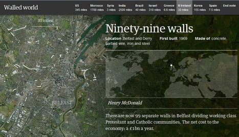
This article explains how the world is filled with division and segregation. Some of the most notable are the walls are the wall in berlin, the wall/border/river/fence between the u.s. and mexico and the border between north and south Korea is the most notable walls.
This article relates to unit 4 because it shows how people, through borders, have divided them through history creating new politics, culture and borders themselves. The political processes involved can change the policies and shapes of nations in the world.
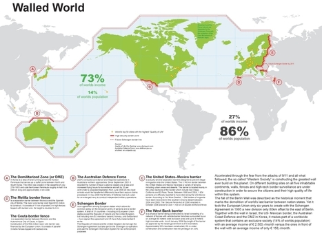
This map shows that hi-tech political surveillance of borders is highly correlated with the core areas of the global economy and some of the most attractive immigrant destinations.
Questions to Ponder: What else do you see in this map? What does this say about the world order? Are there patterns that this map reveals/conceals?