

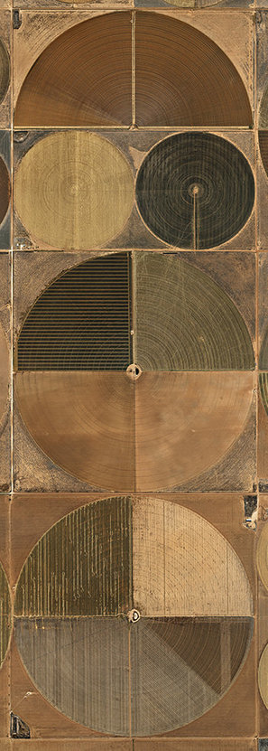

Using aerial photographs that render imperiled landscapes almost abstract, Edward Burtynsky explores the consequences of human activity bearing down on the earth’s resources.
Get Started for FREE
Sign up with Facebook Sign up with X
I don't have a Facebook or a X account


 Your new post is loading...
 Your new post is loading...
Your new post is loading...
Using aerial photographs that render imperiled landscapes almost abstract, Edward Burtynsky explores the consequences of human activity bearing down on the earth’s resources. 
Yesterday was Earth Day, a time set aside to increase awareness of the natural environment and the impact of our collective actions...
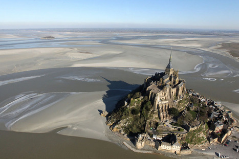
This is a gorgeous set of 39 images that are all view the Earth and captures images for above. These aerial photography and remote sensing images focus of a wide range of topics such as the cultural landscape, the environment, earth science, cultural ecology and urban systems. The photo above is of Mont-Saint-Michel, a tourist attraction and UNESCO world heritage site in northwestern France that is the world's premier example of the tombolo landform.
|
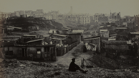
"Charles Marville photographed Paris' transition from medieval hodgepodge to modern metropolis. Marville made more than 425 photographs of the narrow streets and crumbling buildings of premodern Paris, including this view from the top of Rue Champlain in 1877-1878."
|


These images may be very useful for teaching the DCI's under the Human Impact topic.
Is this evidence of homgeniziation of landscapes?