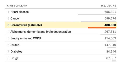

How the best- and worst-case scenarios compare with other common killers.
Get Started for FREE
Sign up with Facebook Sign up with X
I don't have a Facebook or a X account


 Your new post is loading...
 Your new post is loading...
Your new post is loading...
How the best- and worst-case scenarios compare with other common killers.
PIRatE Lab's insight:
This is a fantastic example of data journalism and a good illustration of how you can let data (and the exploration of data) be a key element in informing of a reader about a pressing issue.

No comment yet.
Sign up to comment
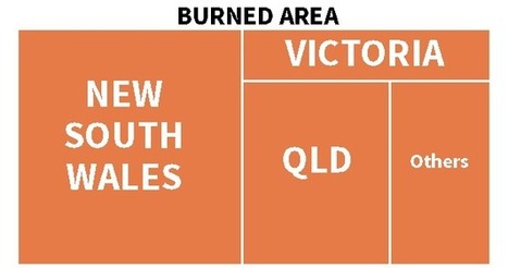
More than 10.3 million hectares of land have been razed by bushfires across Australia
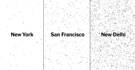
From the Bay Area to New Delhi, explore air pollution around the world.
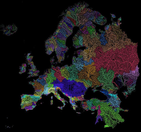
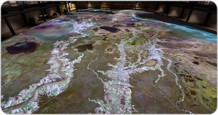
Nothing is more fundamental to life than water - so see the world's watersheds like never before with these colorful and absolutely stunning maps.

KATOWICE, Poland -- Seeing both forests and trees is about to get easier, thanks to a new open-access tool developed by US National Aeronautic
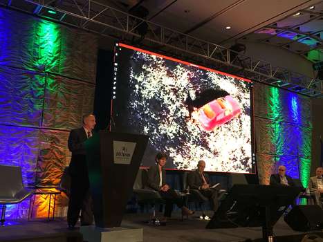
DroneUp, LLC attended The Virginia Governor’s Transportation Conference (GTC) at The Hilton Main in Norfolk, Virginia for the states annual gathering of transportation professionals. Attendees gather each year to be updated on the latest developments in the industry from both the private and public sectors. CEO, Tom Walker, was one of five panellists alongside Cathy …
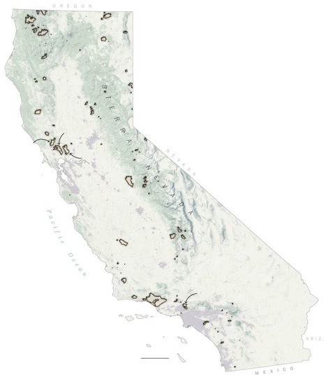
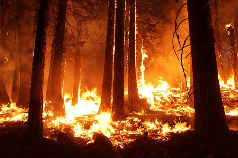
Nearly 9,000 wildfires tore through the state, burning 1.2 million acres of land (an area the size of Delaware), destroying more than 10,800 structures and killing at least 46 people.
Not much, it turns out. Your smartphone will do. Or a point-and-shoot camera. The main objective is to create images of and about your environment that have significant impact and may help to tell a
PIRatE Lab's insight:
Some good tips on the click-through.
|
As discussed previously, the “impeach this” map has some issues. Mainly, it equates land area to votes, which makes for a lot of visual attention to counties that are big even though no…
PIRatE Lab's insight:
This is a great illustration of how choice of map and visualization style/format can lead the viewer to different conclusions. I was watching the hearsing today (on a very small screen) and actually snapped a picture of the hearings when the Congressman put up this 2016 voting map. Partly I did so as I thought it wasn't related to the key point of the hearing, but an interesting rhetorical strategy. But mostly I snapped that pic as it was a classic example of the coastal-inland dichotomy that pervades so much of our current culture. This visualization example hit the nail on the head and is a fantastic example illustrating choices in map making. This is a fantastic exercise for any intro GIS class! See also:
Learn how to visualize and experiment with some wildfire data using R.
The gas rush is upending communities with traffic and noise, reshaping the way the state looks and sounds. Residents are often powerless to stop it.
PIRatE Lab's insight:
This is a great example of how a story map, m=embedded into a blog or new post can really add depth, interactivity, and allow the reader to get a better sense of the subject matter.
Part of the series Harvesting Peril, about agriculture, climate change and the American Farm Bureau's influence.
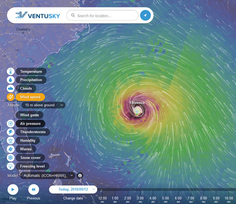
Animated wind, rain and temperature maps, detailed forecast for your place, data from the best weather forecast models such as GFS, ICON, GEM

K Rome's curator insight,
October 6, 2018 7:37 PM
With people on the East Coast concerned about the possible trajectories for Hurricane Florence, I think it is the right time to share these two interactive maps: Ventusky and Windy. In the past, I also shared NullSchool's mesmerizing digital globe with wind data and many other options. Collectively, these my three favorite online visualization of meteorological data. Any other favorites? To friends and family in the Carolinas, stay safe.
Scoop.it Tags: physical, weather and climate, mapping, visualization. WordPress TAGS: physical, weather and climate, mapping, visualization.
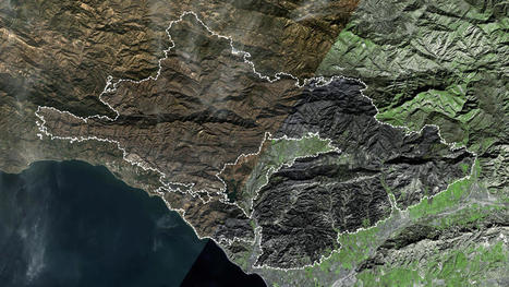
On Dec. 4, the largest wildfire in California history erupted in the mountains near Santa Paula. It would burn for weeks, outlast punishing rains, create deadly debris flows and leave at least 19 dead. Here’s how it happened.

The UN is warning that we are now on course for 3C of global warming. This will ultimately redraw the map of the world
PIRatE Lab's insight:
One of the biggest resulting threats to cities around the world is sea-level rise, caused by the expansion of water at higher temperatures and melting ice sheets on the north and south poles. Scientists at the non-profit organisation Climate Central estimate that 275 million people worldwide live in areas that will eventually be flooded at 3C of global warming.
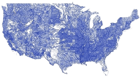
A recent report by the U.S. Environmental Protection Agency concluded that 55 percent of U.S. rivers and streams are in poor condition. Many of us might not realize just how many rivers and streams there are in the United States. This map gives you an idea of how many there are; visit the link to see many beautiful different visualizations of rivers in the U.S., as well as an interactive map that you can play with and zoom in and out of to see the rivers in your area. All river data comes from the NHDPlus dataset, a geo-spatial, hydrologic framework dataset envisioned by the US Environmental Protection Agency. Via Lauren Moss
|