

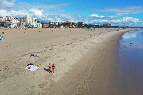
California's landscape of everyday life is changing under the state's stay-home order. These drone photos prove it.
Get Started for FREE
Sign up with Facebook Sign up with X
I don't have a Facebook or a X account


 Your new post is loading...
 Your new post is loading...
Your new post is loading...
California's landscape of everyday life is changing under the state's stay-home order. These drone photos prove it. 
No comment yet.
Sign up to comment
Rwanda forges forward in drone mapping use After Rwanda made waves in the news early last year for allegedly being the first country to approve drone delivery, people paid attention. The country, with its rolling hills and one of the fastest growing economies in Central Africa, has already established regulations regarding drones and become a …
Chase Tillman's insight:
A university in Rwanda is on par or even ahead of the states relative to education of drone use. They are using Pix4d in their course on photogrammetry. Aerial mapping is very useful in Africa due to the large amount of subsistence farming and the lack of up-to-date maps. I am very optimistic about the increased use of drones in the future as well as the benefit they supply to societies in the world - whether they are under-developed or global leaders, there may always be a use.
|
From
vimeo

https://www.instagram.com/paraicmcgloughlin/?hl=en Film by Páraic McGloughlin A brief look at the earth from above, based on the shapes we make, the game…
|


