
History map of Australia and New Zealand 1788-1911, illustrating the Commonwealth of Australia (1901), routes of Stuart, 1858 - 1862, routes of Giles and Forrest, 1874 - 1876, Overland telegraph line (1872), Railways, and New Zealand...
Get Started for FREE
Sign up with Facebook Sign up with X
I don't have a Facebook or a X account


|
Scooped by
Catherine Smyth
onto Primary history- The Australian Colonies April 11, 2013 12:09 AM
|
History map of Australia and New Zealand 1788-1911, illustrating the Commonwealth of Australia (1901), routes of Stuart, 1858 - 1862, routes of Giles and Forrest, 1874 - 1876, Overland telegraph line (1872), Railways, and New Zealand...


 Your new post is loading... Your new post is loading...

Primary teachers may be familiar with an inquiry process but less so with HISTORICAL INQUIRY. This British website draws on pedagogical research and explores how teachers can develop historical understanding in their classroom. The "Enquiry discussion" section is particularly useful. Via Catherine Smyth
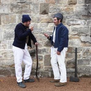
Explore what life was like for convicts in the colonies. This website contains a range of engaging primary and secondary sources organised around aspects of life including food, clothing, language, work, escape. Via Rachel Lee

Rachel Lee's curator insight,
May 31, 2018 10:10 AM
This interactive website could be used as the starting point for the historical inquiry about investigating the daily lives of convicts during post-1800 colonial Australia (ACHHK094) (NESA, 2012). The website is abundant with both secondary and primary sources that have been curated by historians and organised for easy accessibility. The language is accessible for Stage 3 students and accompanied with pictures, which could appeal to EAL/D students (Hertzberg, 2012). Through this resource, students could explore the historical concepts of continuity and change, perspectives and empathetic understanding, through the skills of comprehension, analysis and use of sources, and research (NESA, 2012) by examining the daily life of some Australian convicts. Students could work in groups, using ICT, to research and present information about an allocated aspect of life as a convict, as computer-assisted methods of presentation could improve student learning and enjoyment (Rankin and Hoaas, 2001). Conducting historical inquiry with technology, using resources such as ‘Day in the Life of a Convict’, facilitates the development of historical thinking, enhances computer literacy, and sharpens critical thinking and problem solving (Yang, 2009). Teachers could use this resource to explore the lives of convicts during particular years in the 1800s, which could be used to investigate this topic in a micro perspective, as this curation of resources sees the 1800s in a macro perspective. Reference List: NESA. (2012). History K-10 syllabus. Retrieved from https://syllabus.nesa.nsw.edu.au/hsie/history-k10/ ; Rankin, E. L., & Hoaas, D. J. (2001). Teaching note: does the use of computer-generated slide presentations in the classroom affect student performance and interest?. Eastern Economic Journal, 27(3), 355-366. Retrieved from http://www.jstor.org/ Yang, S. C. (2009). A case study of technology‐enhanced historical inquiry. Innovations in Education and Teaching International, 46(2), 237-248. DOI: 10.1080/14703290902844040
Catherine Smyth's insight:
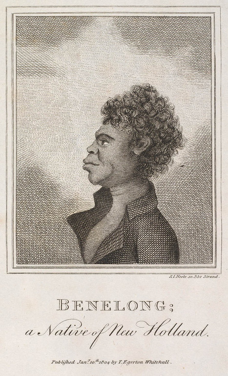
Bennelong was an Eora man captured by Governor Phillip. Bennelong travelled to England and back, and taught the settlers much about Aboriginal language and culture.
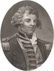
William Bligh (1754-1817), naval officer, was born in Plymouth and first went to sea at around the age of eight.
Learn about Australia's longest continually operating public clock and the effect it had on the early colony. Music written and performed by Cameron Emerson-...

Explore, play and learn with ABC Splash. Over 2500 videos, games and other resources. All mapped to the Australian curriculum.
Catherine Smyth's insight:
In Year 5 and 6, students learn about the nature of convict or colonial presence, including the aspects of their daily life. What was life like for convicts? Where did they live? What did they eat? What did they wear? Watch an historian talk about punishment shoes worn by convicts in Tasmania.
This Video takes an informed look at the Gold Rushes and early prospecting in Australia. The Video covers the first Gold Rushes of the 1850's and how other d...

Amy Baker's curator insight,
March 29, 2014 11:46 PM
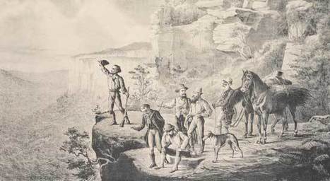
The State Library of NSW houses collections of documents. This website provides access to resources which tell the story of explorers' attempts to cross the Blue Mountains including journals, watercolour drawings and maps.
This site describes modes of transport in the 1800s including the use of pack horses and gives students an idea of how tedious travel was. Students could compare the journey in the 1800s and the journey today with the availability of modern transport. Students could study the development of infrastructure, in particular the construction of a railway.
The site also contains images of William Lawson and William Charles Wenthworth’s journals. Journals could be used as a literacy tool and students could read and compare other historic journals or write their own journals based on historical events.
The maps could introduce the students to cartography and lead into a unit which examines other areas and types of maps. Students could undertake activities such as making maps which are relevant to their lives, such as for the local area.
Exploration of the Blue Mountains will be of particular interest to Sydney students because it is within close proximity to where they live but many students will not have been there. This topic could involve an excursion to the Blue Mountains for students to see the terrain and gain an understanding of the hardship of colonial exploration.
Catherine Smyth's insight:
The discovery of gold was a significant event in colonial Australia- but why? The organisation of this website around key ideas provides a snapshot of what life was like on the gold fields. The website covers a range of perspectives (women, Chinese and indigenous) and includes a range of primary and secondary sources.

From
aso

Conrad Martens, whose watercolours are a valuable record of colonial Sydney, is reputed to be its first successful artist. (Video excerpt 2.32 minutesalso has educational notes. This clip chosen to be PG)
Catherine Smyth's insight:
Paintings are a valuable source of information about a place in the past and can be used to develop historical understanding of concepts such as change and continuity or significance. Use this short clip of Conrad Martens' paintings to show what Sydney was like in the 1830s-1870s.

Catherine Smyth's curator insight,
March 9, 2014 8:20 PM
What did Sydney look like in the 1800s? Use this short clip of paintings by Conrad Martens to show significant buildings and land forms of the early colony. Teaching notes accompany the clip.
Catherine Smyth's curator insight,
March 9, 2014 8:25 PM
Use primary sources, such as paintings that were done at the time, to show what places were like in the past. In this 2 minute clip, the paintings by the artist Conrad Martens, provide a historical record of the early Sydney colony from 1835-1870.
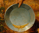
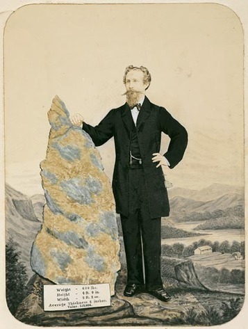
The discovery of gold in Victoria created years of wealth for the young colony. Here was a metal that could liberate servants from their masters and sometimes set those masters off to dig for gold themselves.
Catherine Smyth's insight:
The discovery of gold is a significant event in Australia's history. Here are some useful teaching resources around the topic of life on the goldfields and the impact on society.

More than 160,000 women were among the 600,000 who arrived in Victoria between 1851 and 1860.
Catherine Smyth's insight:
A woman's voice is heard loud and clear in this range of primary sources from the Australian gold fields.
|

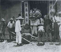
This short documentary explores the story of Chinese people in the Victorian gold rush, uncovering t…
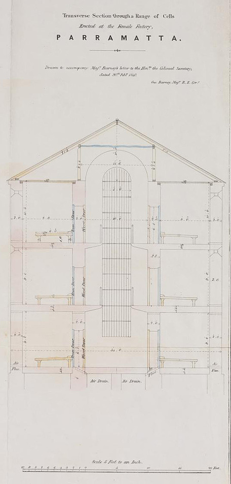
Named for its traditional owners, the Burramattagal, Parramatta was the site of the second European settlement in Sydney, and an early successful farm.
Catherine Smyth's insight:
This site contains a range of primary and secondary sources that teachers can use to teach the Stage 3 history topic "The Australian Colonies". The digitised primary sources include maps, images, buildings and other records from Parramatta in the early 1800s. Parramatta, named for its traditional owners, the Burramattagal, was the second European settlement in Sydney.
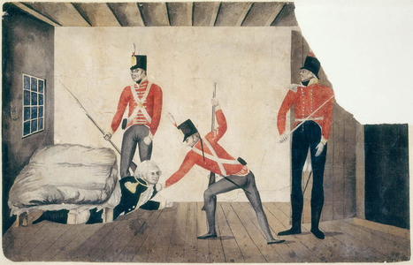
Catherine Smyth's insight:
The 1808 Rum Rebellion was Australia's first and only military coup. Listen to historian, James Dunk make sense of this significant event in early colonial Australia.
Explore, play and learn with ABC Splash. Over 2500 videos, games and other resources. All mapped to the Australian curriculum.
Catherine Smyth's insight:
This short clip explores the role that Aboriginal and Torres Strait Islanders played in shaping a colony. Early colonists in Australia often struggled to produce enough food to feed themselves, while Aboriginal peoples had known for many thousands of years how to survive on the same land.
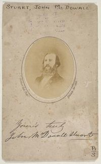
Find out more about early European explorers of inland Australia including Ludwig Leichhardt, Robert O'Hara Burke and William John Wills, John McDouall Stuart and Edmund Kennedy. NSW schools can also book an Early Explorers: Trailblazing the Australian Interior workshop for Stage 2 students - for more information, see the Library's school program. (http://www.sl.nsw.gov.au/services/learning_at_the_Library/2013_school_program.html).
Catherine Smyth's insight:
Teaching about early Australian explorers? Check out the online digital collection of primary sources on this NSW State Library Pinterest board.

Nerolie Callaghan's curator insight,
October 23, 2015 8:24 AM
Another good resource to learn some about some of the explorers.
Discover more about the Australian goldrushes of the 19th century and the lives of those who worked the goldfields
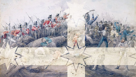
Today is a significant day and not just because it's the last BtN of the year. It's also the anniversary of a very famous event in Australia's history called the Eureka Stockade. Sarah visited Ballarat in Victoria to find out what it was and why it's so important. Via Laura Griffiths

Laura Griffiths's curator insight,
April 6, 2014 3:03 AM
A significant incident during the Australian gold rush period was the Eureka stockade and today, it is recognised as being an event that shaped Australia’s political landscape. This BtN report covers the importance of the Eureka Stockade not only for the miners during the 1850s but its continuing effect on Australia’s democracy. Educational television programs like BtN have been recognised as effective resources teachers can utilise as they raise current problems and issues, have the ability to stimulate student curiosity and allows for discussion (Marsh, 2010, p. 247).
This BtN report would be appropriate to show to students within the classroom due to its comprehensible information and its engaging and entertaining format. It would be beneficial for teachers to use this clip as a foundation and an introductory activity on the importance of the Eureka stockade and its effect on Australia’s political landscape. Students should watch the clip twice – firstly as enjoyment and secondly to record information relevant for follow up discussion and activities. A scaffold should be provided for students while watching the video so they know what they should be listening to. After watching the clip twice, teachers should instigate a discussion identifying what students learnt from the video and what they have written in the scaffold. The BtN website provides questions that teachers can draw upon to discuss the Eureka Stockade Report. However, teachers should also provide discussion points and questions to link the Eureka stockade and its effect on shaping Australia as a democracy and Australia’s identity. It is important that teachers have a discussion after viewing this news report because it allows teachers to identify if students understood the information presented, assess if students were listening as well as receive an indication if further clarification is needed on particular aspects. If students do require more explanation, the website provides other links teachers and students can access for more information. Linked websites include the Museum of Australian Democracy Eureka website, Australian Government website on the Eureka Stockade and the State Library of Victoria website.
Reference: Marsh, C. (2010). Becoming a teacher: Knowledge, skills and issues. Frenchs Forrest: Pearsons.
Historians Dr Shirley Fitzgerald and Dr Lisa Murray chat about the evolution of Sydney's streets and their names. For more Sydney History visit www.cityofsyd...
As much as there may have been some opportunities for fun and fossicking, children would have suffered through the same basic living conditions and harsh weather on the goldfields.
Catherine Smyth's insight:
What was life like for children on the goldfields?

Primary sources written by women from the goldfields are few and far between. Diaries such as this provide a valuable insight into a word we rarely see. Sarah Davenport, diary.
Catherine Smyth's insight:
The gold rushes of the 1850s saw an influx of Chinese migrants to Australian colonies.
|


What is this a map of? Who created it? Why was it created?
Use this primary source to stimulate discussion about British colonisation. Before showing this map, display an Aboriginal Languages map. Students can compare the two maps with a more recent map of Australia. To develop historical understanding, pose questions, analyse primary sources and then construct an historical narrative.