

Via Annick


|
Rescooped by
Catherine Smyth
from HSIE CCS2.1 Aboriginal resistance to the establishment of a British colony
onto Primary history- First Contacts April 17, 2015 11:38 PM
|

|
Primary history- First Contacts
Teaching resources, ideas and links for the Stage 2 Australian curriculum topic "First Contacts". In this topic, students describe people, events and actions related to world exploration and its effects, describe and explain effects of British colonisation in Australia and apply skills of historical inquiry and communication Curated by Catherine Smyth |
 Your new post is loading...
|
|
Rescooped by
Catherine Smyth
from Primary history- British Colonisation
February 19, 2013 1:56 AM
|
|
|
Rescooped by
Catherine Smyth
from Stage 2 History - Contacting the shores of Australia
June 27, 2018 4:32 AM
|
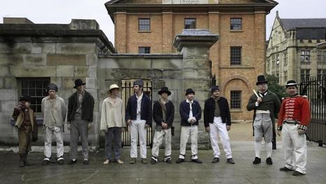
Wow. This unique treasure opens up a rare perspective of First Contacts. Stage 2. Digitised pimary source. @mareewhiteley #histedchat #edchat #Aboriginalperspectives #museums

|
|
Rescooped by
Catherine Smyth
from First Contacts- Stage Two
June 25, 2018 1:42 AM
|


|
|
Scooped by
Catherine Smyth
May 11, 2018 1:52 AM
|
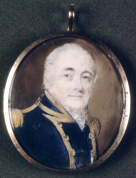
William Bligh served as Governor of NSW from 13 August, 1806- 26 January, 1810.
Through the Stage 3 history topic, 'The Australian Colonies', students have the opportunity to "investigate the everyday life of a variety of men and women in post-1800 colonial settlements using a range of sources..." (NESA History K-6 syllabus, Stage 2 content).
|
|
Rescooped by
Catherine Smyth
from My Home, Your Home, Our Home: Interconnectedness of the Australian continent (Stage 2 Geography).
May 15, 2016 8:48 PM
|


|
|
Scooped by
Catherine Smyth
May 15, 2015 12:36 AM
|

The nature of contact between Aboriginal people and/or Torres Strait Islanders and others, for example, the Macassans and the Europeans, and the effects of these interactions on, for example families and the environment (ACHHK080)
|
|
Scooped by
Catherine Smyth
May 7, 2015 2:31 AM
|

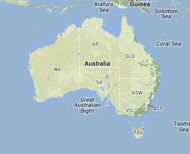
Aboriginal people and place Sydney Barani history Gadigal
|
|
Scooped by
Catherine Smyth
April 19, 2015 1:02 AM
|

Significant Aboriginal people in Sydney Sydney Barani Aboriginal history
|
|
Rescooped by
Catherine Smyth
from CCS2.1 Changes to People and Places in Sydney region as a result of British colonisation
April 18, 2015 3:18 AM
|

A timeline of events relating to Indigenous Australians from the time of contact with Indonesian trepang fishermen c.1500-1700 until 1900.

This timeline of events relating to Aboriginal people before and after British Colonisation would be a good teaching resource for Stage 2 HSIE students, as well as achieving several Mathematics and English syllabus outcomes.
Prior to students engaging with new information, it's important to determine students’ prior learning (Gilbert & Hoepper, 2011, p.68). For example, the teacher could tape a line along the classroom wall that is approx 4 metres long and explain to students that this timeline represents 80, 000 years of Aboriginal people living in Australia. Ask students to indicate by putting marks on the line showing how long Australia has been settled by white people, before explaining that the last centimetre represents the 200 approx. years since British colonisation. Discuss this representation of the colonisation of Australia compared to students’ perception of the length of time.
Using the Australian Museum timeline, the teacher could pick some key events (particularly around 1786 and early 1800s) that created significant change in Sydney and discuss these events with the students (some of the language in the timeline may need to be modified for Stage 2 students). The timeline of events clearly shows evidence that the lives of Aboriginal people were profoundly changed by the arrival of British colonists in 1788.
A lesson idea would be to divide the class into smaller groups, and allocate each group with a significant event as recorded on the timeline. Instruct students to engage in the process of historical inquiry by conducting further research upon their given event, and to create a summary on A4 paper using both written text and pictures.
For example, one group might research the small pox epidemic that occurred in the late 1700’s/early 1800’s that significantly reduced the Aboriginal population, another group could investigate the loss of land and water resources to Aboriginal people due to European settlement, and another group could look at the loss of Aboriginal people through direct fighting with the colonisers.
When students have completed the task, they will be required to place their page summary in the correct chronological order on the timeline on the classroom wall.
Evidence of learning would be students understanding the First Fleet landing within the long history of Indigenous Australia, describing some of the consequences of British colonisation for Aboriginal people such as displacement, disease, genocide and war, and also correctly placing historical events in sequential order on the classroom timeline and how they occurred in relation to one another. Students could also assess each other by using a checklist to assess if students have contributed and can work together as a group (Gilbert and Hoepper, 2011, p. 138).
REFERENCES:
Gilbert, R., Hoepper, B. (eds) (2014). Teaching humanities and social sciences: history, geography, economics and citizenship in the Australian curriculum. South Melbourne: Cengage Learning Australia.
NSW Board of Studies (2012) Mathematics K-10 Syllabus, Retrieved March 31, 2015, from http://syllabus.bos.nsw.edu.au/mathematics/
|
|
Rescooped by
Catherine Smyth
from HSIE CCS2.1 Aboriginal resistance to the establishment of a British colony
April 17, 2015 11:38 PM
|

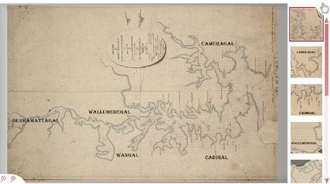
This chart of Port Jackson NSW as surveyed by Capt.John hunter in 1788, documents the Eora clan territories from a range of sources and records kept by English colonists. This resource can be used in the classroom to help students “investigate the local area to identify the peoples who originally lived there and those who live there now” which is a key indicator of CCS2.1 ‘Significant Events and People’ (Board of Studies, 2006, p.23). It should be highlighted that this map was not created by the Eora people but through multiple British sources for the purpose of representing the territories of the Aboriginal communities that lived there in 1788. It should also be recognised that even today cartographers still struggle to map Aboriginal linguistic and land boundaries especially since over time Aboriginal people have been displaced and knowledge of boundaries have been lost (Kohen, 1995, p.32).
Consulting with Aboriginal Communities
Prior to teaching Aboriginal content, it is important to first consult with your local Aboriginal community first to understand “the views and knowledge of Aboriginal people in order to develop, implement and evaluate the way Aboriginal studies and perspectives will be taught” (Board of Studies, 2008, p.4). This resource should only be used with guidance from local Aboriginal communities or after consultation with the AECG http://www.aecg.nsw.edu.au/.
Lesson Integration
The Eora map could be compared to a current map of greater Sydney, such as this one: http://www.environment.nsw.gov.au/images/grants/cmsydhbrdec051000.gif. The Eora map could be printed multiple times and cut up based on different community territories. Different territories could be given to half of the class, whilst the other half would be given the current map of Sydney. The aim of the activity would be to work together to identify the Eora territories on the most current map of Sydney by marking it out and writing the names of the Eora clans on the new map. The purpose of this task is for students to recognise the traditional owners of the land and to identify local places in terms of its significance to the Eora people. A discussion surrounding the findings and significance of these places should follow.
References
- Board of Studies Syllabus, NSW (2006).Human Society and Its Environment K-6 Syllabus. Sydney:
B.O.S. Retrieved from http://k6.boardofstudies.nsw.edu.au/wps/portal/go/hsie
- Board of Studies.(2008). Working with Aboriginal Communities: A guide to community consultation and protocols. Retrieved from http://ab-ed.boardofstudies.nsw.edu.au/files/working-with-aboriginal-communities.pdf
- Kohen, J. L. (1995). Mapping Aboriginal linguistic and clan boundaries in the Sydney region. Globe, The, (41), 32 – 39.
|
|
Rescooped by
Catherine Smyth
from HSIE CCS2.1 Aboriginal resistance to the establishment of a British colony
April 17, 2015 11:38 PM
|
Reconciliation Australia presents our shared history via an online timeline that documents the impact of British colonisation on Australia’s first people. The timeline is interactive and allows students to explore significant Aboriginal events, places and individuals throughout time. Starting 60,000 years before contact, this timeline is an excellent resource to help students learn about significant dates from an Aboriginal perspective, allowing students to locate and reference important dates in chronological order. According to Arthur and Phillips (2000, p.88 - 91) children struggle to understand abstract markers of time however visual evidence and visual coding in the form of a timeline can help children actively process their thinking about time.
Lesson Integration
Students could use this timeline as a basis to create their own online timeline using Dipity http://www.dipity.com/, which is a free digital timeline website. Students could collaborate in pairs to create a rich timeline that include dates that are significant to Aboriginal’s particularly in regards to their resistance to colonisation. Students should then expand on the selected dates by searching for videos, images, websites and other resources that can help clarify their understandings of these dates. Students could then share their timelines with their peers. This assessment will assess students ability to “sequence significant events related to human occupation in Australia” which is an indicator of stage 2 CCS2.1 ‘Significant Events and People’ (Board of Studies, 2006, p.23).
References
- Arthur, J., & Phillips, R. (2000). Issues in history teaching. New York: Routledge, 88 -91.
- Board of Studies Syllabus, NSW (2006). Human Society and Its Environment K-6 Syllabus. Sydney:
B.O.S. Retrieved from http://k6.boardofstudies.nsw.edu.au/wps/portal/go/hsie
|
|
Rescooped by
Catherine Smyth
from HSIE K-6
March 25, 2015 1:48 AM
|
Guides. Children's and Young Adult Literature (Education). Aboriginal and Torres Strait Islander Perspectives.

This is a comprehensive online collection of teaching resources, reference material and websites that address Aboriginal and Torres Strait Islander perspectives.
Evaluate curriculum resources using selection criteria (see link in menu on the left of the page).
|
|
Scooped by
Catherine Smyth
March 1, 2015 7:47 PM
|

This collection focuses on the European mapping and naming of the Australian continent during the 17th and 18th...
What did European explorers know about the world in 17th and 18th centuries? How did they know?
|
|
Scooped by
Catherine Smyth
March 1, 2015 6:57 PM
|
If you decide to visit somewhere you've never been before, how do you find your way? If you're in a car, the driver...
Why did people explore the world over 200 years ago? How did explorers navigate their way around the globe? DIscover how Captain James Cook found his way through the interactive resources on the splash website.

|
|
Scooped by
Catherine Smyth
February 18, 2015 6:17 PM
|
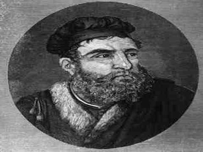
Students learn about world exploration in the Australian Curriculum:history. This short clip gives an overview about the world explorer Marco Polo .
|
|
Rescooped by
Catherine Smyth
from Primary history
February 3, 2015 6:53 PM
|
Stories of convict transportation to Australia, from the collections of the State Library of New South Wales.
Teaching about convicts? Check out this wonderful range of online digital resources on the NSW State Library Pinterest board
Teaching about convicts? Check out the array of online digital resources on this State Library NSW Pinterest board.
|
|
Scooped by
Catherine Smyth
July 2, 2014 12:25 AM
|

Your lesson this week: Convict secrets of The Rocks precinct in Sydney. Your teacher is Associate Professor Grace Karskens from the University of New South Wales. Download the audio file Next week: Sp
In this audio recording, historian Grace Karskens talks about what life was like for convicts living in the Rocks.
|
|
Scooped by
Catherine Smyth
May 5, 2014 9:32 PM
|
Recently we celebrated Australia day on the 26th of January. But why do we mark it on that day in particular? To answer that question, Sarah will take you ba...
This YouTube clip, produced by BTN, tells the story of children who came to Australia on the First Fleet in 1788.
Support materials with teaching ideas include the following key inquiry questions:
When is Australia Day?
Complete the following sentence: The day marks the anniversary of...
Describe life in Britain in the 1700s.
Why were prisoners transported to the colonies?
What sorts of crimes were committed by people who were transported?
How many ships transported convicts in the First Fleet?
What do you think life would have been like on board the ships in the First Fleet?
New _______________ was the name give to mainland Australia.
Who was the commander chosen to lead the colony?
Name three facts you learnt watching the BtN First Fleet story.
|
|
Scooped by
Catherine Smyth
April 27, 2014 2:17 AM
|
Who was Bennelong? This resource uses a range of primary and secondary sources to construct a historical narrative of this significant man. Woollarawarree Bennelong (c.1764-1813) is present in all of the early accounts of the Colony of NSW.
|
|
Rescooped by
Catherine Smyth
from Changes to people and places in the Sydney region as a result of British Colonisation
May 20, 2014 10:51 PM
|
A convict’s life depended on who they worked for, where they worked and the kind of skills they had to offer.

Along with the British Colonisation of Australia came the convicts too. No longer accepted in America after The War of Independence ended, NSW was the answer to the problem for Britain.This site from Sydney Living Museums in conjunction with Historical Houses Trust of NSW focuses on convict life at Hyde Park Barracks. Hyde Park Barracks is heritage listed as one of the most significant convict sites in the world.This is an excellent resource for teachers and students. Children will enjoy this site which includes lots of photos, clear and concise accounts of the daily life of the convicts, actual newspaper articles about them and videos . Excursions can be arranged to Hyde Park Barracks to visit the convict museum which runs educational programs that are directed at stage 2 and 3 and are aligned with the HSIE curriculum.
There are numerous teaching activities that can be inspired by this subject. Recording the differences between a convicts clothing and our own today looking at the food they ate and the food we eat, setting up a mock trial in small groups and determining punishments for the crimes, are but a few suggestions. For a more formal assessment children could research female convicts ( as Hyde Park Barracks was home to male convicts only) and present their findings to the class in a short five minute oral presentation where they would report on the female convicts clothing, crime and punishment, what type of labour they were sentenced to and what became of them if and when they were released ( The National Library of Australia, 2014).
References.
The National Library of Australia. (2014). Retrieved from
Treasure Explorer http://treasure-explorer.nla.gov.au/explore/treasures

|
|
Scooped by
Catherine Smyth
February 2, 2014 11:36 PM
|
Evaluate and select curriculum resources for teaching Aboriginal and Torres Strait Islander perspective using 5 key criteria.
Teachers should consider:
1. Authenticity
2. Balanced nature of the presentation
3. Aboriginal and/or Torres Strait Islander participation
4. Accuracy and support
5. Exclusion of content of a secret or sacred nature.
|
|
Rescooped by
Catherine Smyth
from The Establishment of a British Colony in Australia
May 12, 2014 1:46 AM
|

This is a video about the first fleet and British colonisation in Australia. It focuses on information about Aboriginal ownership of the land and an Aboriginal perspective of first fleet arrival and subsequent settlement by the British by conducting interviews with historians of Aboriginal heritage. The video covers Arthur Phillip’s role briefly. It then goes on to explain that the settlers saw the land as a British territory, not owned by the Aboriginal people who already lived there. The video covers some aspects of early colonial life and then ends with a short reference to the impact of small pox on the Aboriginal population.
This would be a good resource to use to introduce a unit about British Colonisation to students while providing a strong focus on Aboriginal perspective. The Aboriginal perspective on British colonization is one which can be easily overlooked in a classroom, however by introducing the topic with a resource that emphasizes their experience students should be able to see and remember how much of an impact early British settlers had on the lives of the first Australians.
Another way in which this video may be used is (in conjunction with supporting information) to work with the students as a class to create a timeline of British settlement/colonization from the perspective of the Aboriginal people. As a reflection exercise (or assessment) ask the children to replicate the timeline made as a group in their individual workbooks from memory or with only minimal prompts.

Evaluate and select curriculum resources for teaching Aboriginal and Torres Strait Islander perspective using 5 key criteria.
Teachers should consider:
1. Authenticity
2. Balanced nature of the presentation
3. Aboriginal and/or Torres Strait Islander participation
4. Accuracy and support
5. Exclusion of content of a secret or sacred nature.
|
|
Rescooped by
Catherine Smyth
from Exploration, Colonisation and Change: James Cook and Beyond
May 11, 2014 6:59 AM
|

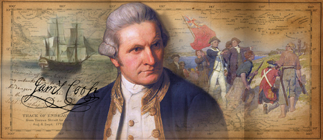
Treasure Explorer is a brilliant, interactive website targeted at Stage 4 students. Everything from the graphics, to the fonts, and activities are thought out to appeal to children. This tool could be implemented in the classroom easily if a smart board is accessible. The teacher could have children stand and compete in the quizzes and activities as a class. The website allows for students to make their own account and add content to it. There is also a section dedicated to teachers which includes a range of resources and lesson ideas to teach students this objective and more. Emphasis is placed on facts and information; as a result, there are multiple quizzes on the content of the website which include questions like, "In what year did Captain Cook declare Australia 'Terra Nullius'?"
The online resources include an image gallery which provides students with various re-enactments and portrayals of Captain Cook's contribution to world exploration in the Eighteenth Century. This is especially important in a present day context in which visual material is more effective and understood than oral or written. We live in the age of technology. Education is moulded by it and children are increasingly more knowledgeable of it than adults. It is the teacher's responsibility to cater to these interests and needs by including mediums that students naturally respond to. The interactive nature and visual material in this website do just that.


This chart of Port Jackson NSW as surveyed by Capt.John hunter in 1788, documents the Eora clan territories from a range of sources and records kept by English colonists. This resource can be used in the classroom to help students “investigate the local area to identify the peoples who originally lived there and those who live there now” which is a key indicator of CCS2.1 ‘Significant Events and People’ (Board of Studies, 2006, p.23). It should be highlighted that this map was not created by the Eora people but through multiple British sources for the purpose of representing the territories of the Aboriginal communities that lived there in 1788. It should also be recognised that even today cartographers still struggle to map Aboriginal linguistic and land boundaries especially since over time Aboriginal people have been displaced and knowledge of boundaries have been lost (Kohen, 1995, p.32).
Consulting with Aboriginal Communities
Prior to teaching Aboriginal content, it is important to first consult with your local Aboriginal community first to understand “the views and knowledge of Aboriginal people in order to develop, implement and evaluate the way Aboriginal studies and perspectives will be taught” (Board of Studies, 2008, p.4). This resource should only be used with guidance from local Aboriginal communities or after consultation with the AECG http://www.aecg.nsw.edu.au/.
Lesson Integration
The Eora map could be compared to a current map of greater Sydney, such as this one: http://www.environment.nsw.gov.au/images/grants/cmsydhbrdec051000.gif. The Eora map could be printed multiple times and cut up based on different community territories. Different territories could be given to half of the class, whilst the other half would be given the current map of Sydney. The aim of the activity would be to work together to identify the Eora territories on the most current map of Sydney by marking it out and writing the names of the Eora clans on the new map. The purpose of this task is for students to recognise the traditional owners of the land and to identify local places in terms of its significance to the Eora people. A discussion surrounding the findings and significance of these places should follow.
References
- Board of Studies Syllabus, NSW (2006).Human Society and Its Environment K-6 Syllabus. Sydney:
B.O.S. Retrieved from http://k6.boardofstudies.nsw.edu.au/wps/portal/go/hsie
- Board of Studies.(2008). Working with Aboriginal Communities: A guide to community consultation and protocols. Retrieved from http://ab-ed.boardofstudies.nsw.edu.au/files/working-with-aboriginal-communities.pdf
- Kohen, J. L. (1995). Mapping Aboriginal linguistic and clan boundaries in the Sydney region. Globe, The, (41), 32 – 39.