Robin Good: The David Ramsey Map Collection is an historical collection of thousands of beautiful maps and atlases organized and made freely accessible to the public online in unique and unprecedented ways.
This is a stunning example of a visual curated collection, offering thousands of beautiful images at very high quality, and multiple ways and tools to navigate this ocean of maps.
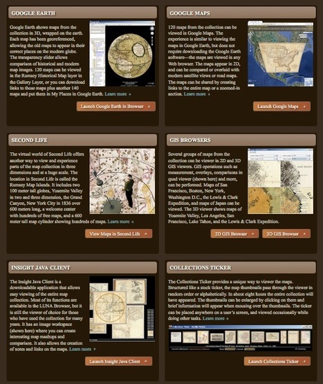
This online collection offers in fact no less than 12 different ways to navigate its contents by providing dedicated browsers and visual imaging tools ranging from 2D-GIS to SecondLife and virtual QTR panoramas. For example, with the Google Earth visualization, any map in the collection can be seen perfectly mapped on the globe, or by using the Luna Browser one can create collections, save and download images, annotate maps or even create embeddable presentations.
All of the images in the collection have been published online at full resolution and are available to download at different quality levels under a Creative Commons License for non-commercial uses.
This is truly a spectacular collection with marvellous maps and atlases enriched by complementary data, visualization tools and a formidable array of navigation devices.
Possibly the best online curated collection I have seen so far.
Must-see. 10/10
About page: http://www.davidrumsey.com/about
Collection and Tools to navigate it: http://www.davidrumsey.com/view
Home page: http://www.davidrumsey.com/
Une magnifique collection de cartes. A découvrir absolument.
Via
Robin Good


 Your new post is loading...

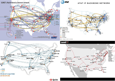


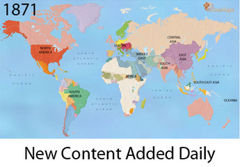


This informative site sheds light on the pervasive workings of the Internet.
A really excellent visual resource for understanding how the Internet has and continues to evolve.
Cette série de cartes accompagnées de commentaires en anglais est absolument remarquable car elle permet de comprendre comment internet s'est imposé à travers le monde.