


 Your new post is loading...

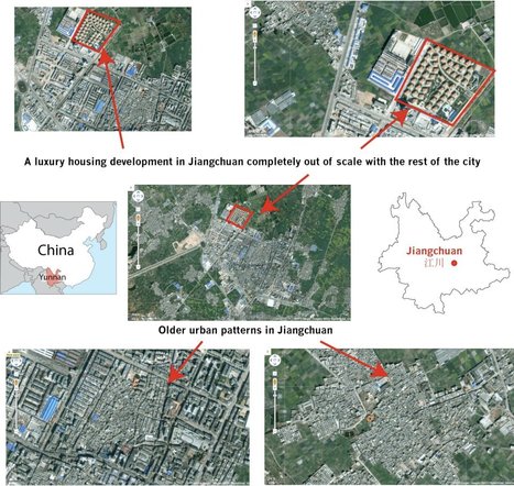

This gallery of Google Earth Screen shots primarily from Yunnan Province in Southern China (bordering Vietnam and Burma) .
This is a great example of using geospatial technologies to interpret the cultural landscape--the merger of 'people and pixels' as the textbook of the same name encourages with classrooms.


In this description followed by images there are all types of vintage points in order to show a clear image of where in relation a time and place a certain society/ country is and to give some background info on what you are looking at by seeing it in multiple images.