Your new post is loading...

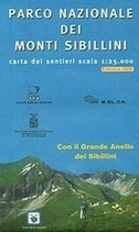

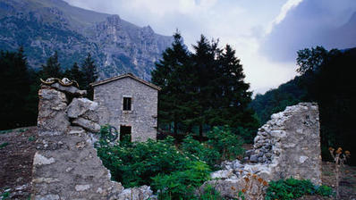
Le Marche: Monti Sibillini National Park on a large, double-sided, contoured and GPS compatible map at 1:25,000 published by Selca in cooperation with Club Alpino Italiano. The map highlights hiking trails, including the Grande Anello dei Monti Sibilini long-distance circuit.
Hiking routes are highlighted and, where appropriate, indicate their waymarking numbers and difficult sections. The course of Sentiero Italia is marked and separate highlighting shows the circular long-distance path Grande Anello dei Monti Sibilini. Symbols indicate locations mountain refuges, shelter and campsites. Also marked are paragliding sites. The map has a 1-km UTM grid.
Also provided are lists of recommended hiking routes and general notes about the area.
Map legend and all text are in Italian only.
Via Mariano Pallottini