


 Your new post is loading...

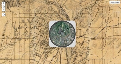

The Smithsonian magazine recently dipped into David Rumsey's collection of over 150,000 maps to find some of the best representations of American cities over the past couple hundred years. With some simple programming, they were able to overlay images of vintage maps of some major cities onto satellite images from today. The results are fascinating.
Via Lauren Moss


I love interactive maps, and history is fascinating... let's take a look!
Great for comparrison and reasoning