


 Your new post is loading...


A new exhibit from the San Francisco Planning and Urban Research Association showcases the simple visualizations of complex ideas that have changed how we live.
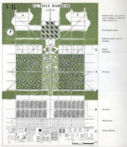
The exhibition’s title – Grand Reductions – suggests a simple illustration’s power to encapsulate complex ideas. And for that reason the medium has always been suited to the city, an intricate organism that has been re-imagined (with satellite towns! in rural grids! in megaregions!) by generations of architects, planners and idealists.
In the urban context, diagrams can be powerful precisely because they make weighty questions of land use and design digestible in a single sweep of the eye. But as well-known plans, such as Le Corbusier’s, illustrates, they can also seductively oversimplify the problems of cities. These 10 diagrams have been tremendously influential – not always for the good...
View all the diagrams as well as their descriptions at the article link...
Via Lauren Moss


Fascinating article. I love planning history.