


 Your new post is loading...

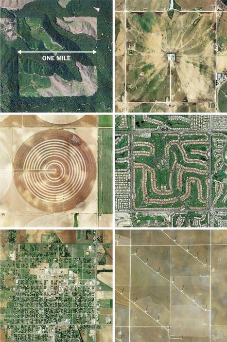

"The images here, taken from the Instagram account @the.jefferson.grid show just a few of the landscapes that can be squeezed into the one-mile squares. The idea behind this sprawling checkerboard emerged after the Revolutionary War. As the United States expanded westward, the country needed a systematic way to divide its newly acquired lands. The original colonies were surveyed using the British system of 'metes and bounds,' with parcels delineated using local geography.
That approach doesn’t scale very well, and Jefferson proposed to slice the young United States into gridded plots of land. Jefferson's idea became a reality in 1785 when it was enacted as the Public Land Survey System. Today his grid covers much of the country, and it is still used to survey federal lands — an idea that shaped the physical landscape of half a continent."
Tags: images, land use, landscape, social media, planning, spatial, scale, historical.


No such thing as being off the grid really. ~ Ron Sandack
unit 1 and 4