


Research and publish the best content.
Get Started for FREE
Sign up with Facebook Sign up with X
I don't have a Facebook or a X account
Already have an account: Login

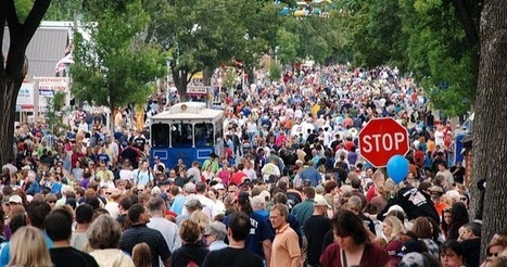
SoRo class
3.9K views |
+0 today
 Your new post is loading...
 Your new post is loading...
Your new post is loading...
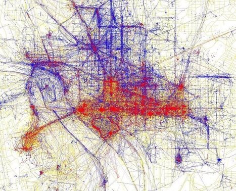
"Tourists and locals experience cities in strikingly different ways. To see just how different these two worlds are, have a look at the map of Washington D.C. above based on where people take photos. The red bits indicate photos taken by tourists, while the blue bits indicate photos taken by locals and the yellow bits might be either." 
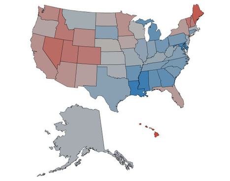
The happiest city in America is Napa, California -- and the saddest all swear too much.
|
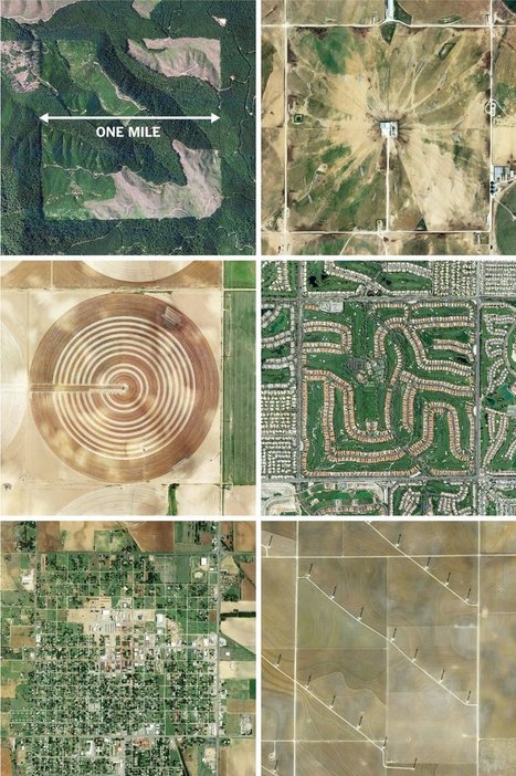
"The images here, taken from the Instagram account @the.jefferson.grid show just a few of the landscapes that can be squeezed into the one-mile squares. The idea behind this sprawling checkerboard emerged after the Revolutionary War. As the United States expanded westward, the country needed a systematic way to divide its newly acquired lands. The original colonies were surveyed using the British system of 'metes and bounds,' with parcels delineated using local geography. That approach doesn’t scale very well, and Jefferson proposed to slice the young United States into gridded plots of land. Jefferson's idea became a reality in 1785 when it was enacted as the Public Land Survey System. Today his grid covers much of the country, and it is still used to survey federal lands — an idea that shaped the physical landscape of half a continent." Tags: images, land use, landscape, social media, planning, spatial, scale, historical.

Dyna-e International's curator insight,
September 1, 2015 12:32 PM
No such thing as being off the grid really. ~ Ron Sandack
Rebecca Gajecki remembers when she researched her school papers by going to the library and looking stuff up in books. Via Dr. Susan Bainbridge

Stephen Dale's curator insight,
March 14, 2014 5:23 AM
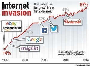
Do you remember the days before you carried around the world in your pocket?
That would have been before Tim Berners-Lee, a British computer scientist, submitted his proposal for what became the Web back in March of 1989. The Web turned 25 years old this week and it's hard to imagine an invention or process that has changed our lives as much in recent history, impacting everything from political movements to our love lives. |


