


 Your new post is loading...

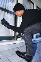

Learn how criminals are using Google Maps Street View to help them 'case the joint' before they rob your house.
Criminals can use Google Maps Street View to:
Locate entrances to buildingsDetermine locations of security cameras, gates, etcFind good hiding places such as in shrubs and other areasFind holes or weak spots in perimeter fencesLocate utility boxes (power, water, gas, etc)See what make, model, and color of vehicle a building occupant or resident drivesSee if locks, guards, dogs, etc, are normally presentMeasure distances between objects (using Google Earth) to determine how quickly it would take to run or drive from one point to another.


One more point to learn about Cyber-Security, on an holistic view...