Learning Claris FileMaker
317.3K views | +9 today
Learning Claris FileMaker
Give life to your data with an easy to use database ... I'll share cool FileMaker stuff for you, avoiding the programming part of it as much as I can.                        #WorkplaceInnovationPlatform #Claris
Your new post is loading...
Scooped by Didier Daglinckx
Scoop.it!

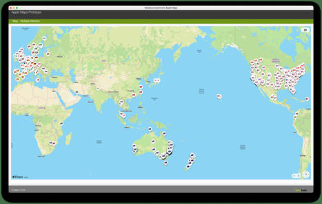
Apple Maps Integration with the Claris FileMaker Platform –

Apple Maps Integration with the Claris FileMaker Platform – | Learning Claris FileMaker | Scoop.it

...


Over the past couple of years I've worked on a number of Apple Maps integrations using Apple's MapKit JS and was also lucky enough to be invited to do a presentation on Apple Maps Integration at the recent EngageU European Claris FileMaker conference in Antwerp, Belgium.


The video of my presentation has just become available on YouTube. 


I've been wanting to write an article on integrating Apple Maps and MapKit JS with the FileMaker Platform so I decided to switch to using Apple Maps for this exercise.


...

Didier Daglinckx's insight:
The video is on EngageU YouTube channel https://www.youtube.com/watch?v=tbqwdUYli14
No comment yet.
Scooped by Didier Daglinckx
Scoop.it!

Map Widget Overview Video | Portage Bay Solutions

Map Widget Overview Video | Portage Bay Solutions | Learning Claris FileMaker | Scoop.it

Combine the power of Google’s mapping technology and your FileMaker solution with Portage Bay’s Map Widget.


In a few easy steps, integrate Google Maps to display interactive location data utilizing Google’s Marker Clustering function along with callbacks to FileMaker.

No comment yet.
Scooped by Didier Daglinckx
Scoop.it!

Integrates Louisiana Coastal Service FileMaker App with ArcGIS Online

Integrates Louisiana Coastal Service FileMaker App with ArcGIS Online | Learning Claris FileMaker | Scoop.it
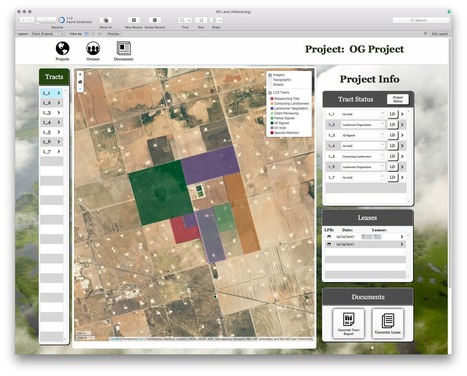
Louisiana Coastal Services (LCS) is a multidisciplinary law firm, land broker, mapping, and project management company that assists in making Louisiana coastal projects a success.

They have extended expertise in many domains, deep local knowledge, and a modern technology toolkit unlike any other firm. Their services include Regulatory Compliance, GIS Mapping, Grant Management, Litigation, and even Risk Management.

ArcGIS Online (AGOL) and FileMaker make up the bulk of LCS’s tech stack.

AGOL is powerful mapping platform that allows you to host data in the cloud and produce maps than can be embedded into websites.

LCS figured out how to display these maps within FileMaker webviewers but quickly realized that wasn’t quite enough.

For example, users wanted to be able to click on tracts and open the corresponding FileMaker record.

They wanted to be able to change the status of a tract project in FileMaker and have the map update the tract feature’s color to reflect this change.

These types of interaction between the web and FileMaker are not trivial.

LuminFire was able to provide them with exactly what they required when other developers failed.


Read more on the blog ...

No comment yet.
Scooped by Didier Daglinckx
Scoop.it!

Maps in FileMaker WebDirect

Maps in FileMaker WebDirect | Learning Claris FileMaker | Scoop.it
Now run SeedCode's ProMaps template within FileMaker Web Direct.

SeedCode creates a session table in ProMaps so users can seamlessly run scripts between from map in FileMaker WebDirect.

No comment yet.
Scooped by Didier Daglinckx
Scoop.it!

Google Maps become affordable | FileMaker Maps

Google Maps become affordable | FileMaker Maps | Learning Claris FileMaker | Scoop.it

Since the introduction of WebViewer, Google Maps were quite popular in FileMaker solutions.


What many FileMaker developers may have missed though is that in most cases they were using Google Maps API illegally and Google could ban their API key or IP address from accessing the feature at any time.


...

No comment yet.
Scooped by Didier Daglinckx
Scoop.it!

Heat Maps in FileMaker | YouTube

No comment yet.
Scooped by Didier Daglinckx
Scoop.it!

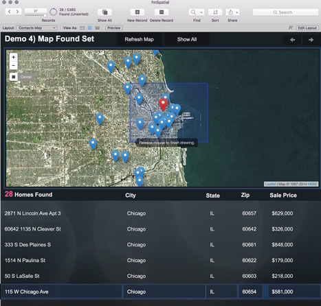
GIS and FileMaker – Part 1: The Basics | Cimbura.com

GIS and FileMaker – Part 1: The Basics | Cimbura.com | Learning Claris FileMaker | Scoop.it

This entry is part 2 of 2 in the series GIS and FileMaker

You’ve read our Mapping and More post.

You know what Geographic Information Systems are.

You’re starting to understand why you need GIS in FileMaker… now let’s get to the how.

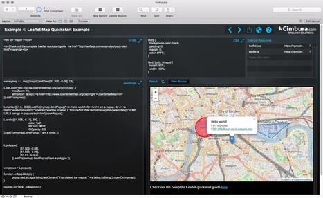
In this post we’re going to cover the basics of creating maps in your FileMaker solutions from built-in, no code required options to interactive Leaflet maps that require just a bit of HTML, CSS, & JS.

If you’re new to web programming and these acronyms make your cringe, don’t fear, we’re providing a demo file with all (**the minimal amount**) of the code you need to get started.

The demo file is actually set up as a sandbox where you can effortlessly experiment with creating maps and other webviewer technologies in FileMaker… more in bit.

For now, let’s dive in assuming you have a database that stores mailing address information in some way, shape, or form and want an interactive map.


Read more on the blog ...

No comment yet.
Scooped by Didier Daglinckx
Scoop.it!

Choosing a Mapping Framework | Cimbura.com - FileMaker tip

Choosing a Mapping Framework | Cimbura.com - FileMaker tip | Learning Claris FileMaker | Scoop.it

Choosing a Mapping Framework


What does a Mapping Framework do?


If you think of web maps as cars, as we discuss in Anatomy of a Web Map (the first of this 6 part series), a Mapping Framework is the engine.

It is a JavaScript library that loads when your web page does.

It manages the display of your map data, handles user interactions with that data (e.g. clicking, scrolling, zooming, etc.) and provides ways for your own custom code to interact with the map and data.


Read more on the post ...

Didier Daglinckx's insight:

This entry is part 2 of 2 in the series Anatomy of a Web Map

(part 1 : Anatomy of a Web Map http://sco.lt/8IK3xB)


No comment yet.
Scooped by Didier Daglinckx
Scoop.it!

Anatomy of a Web Map | Cimbura.com - FileMaker tip

Anatomy of a Web Map | Cimbura.com - FileMaker tip | Learning Claris FileMaker | Scoop.it

Web maps are like cars. It’s easy to appreciate a nice looking web map, but most people don’t need to know about everything that’s going on under the hood. 

Just like when buying car, however, if you understand the basics of how a web map works you’ll be in a much better position to make decisions when building a new one.

Users expect web maps to be everywhere now, in their car, on their watch, on your WordPress web site, in your FileMaker database and anywhere else you present them with mappable data.

This is the first post in a 6 post series which will go through each major component of a modern web map. 

With an understanding of web map essentials you’ll be ready to make important mapping decisions for your website or application.


...


Read more on the blog post

Didier Daglinckx's insight:

Part 2 can be found at http://sco.lt/99DvrV 

(or http://www.scoop.it/t/learning-filemaker?q=anatomy)

No comment yet.
Scooped by Didier Daglinckx
Scoop.it!

Map Icons Collection - 1000+ free & customizable icons for maps | FileMaker UI

Map Icons Collection - 1000+ free & customizable icons for maps | FileMaker UI | Learning Claris FileMaker | Scoop.it
The Map Icons Collection is a set of more than 1000 free and customizable icons to use as placemarks for your POI (Point of Interests) locations on your maps.
No comment yet.
Scooped by Didier Daglinckx
Scoop.it!

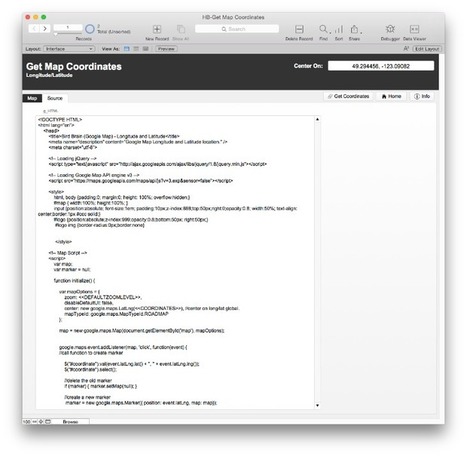
Click, Display, Capture - Google Map Longitude & Latitude into FileMaker Pro

Click, Display, Capture - Google Map Longitude & Latitude into FileMaker Pro | Learning Claris FileMaker | Scoop.it
Using a Javascript overlay on Google Maps and FileMaker’s URL scheme to channel those coordinates into FileMaker records. Click on a map, add longitude and latitude to FileMaker Pro.

This project was brought about by a customer request. They wanted a method of clicking on a Google Map and having the Longitude and Latitude come up that could then be cut and pasted into a FileMaker record. The project was for wildlife observation software sold as a FileMaker Runtime.
No comment yet.
Scooped by Didier Daglinckx
Scoop.it!

FM Starting Point: Maps and GPS Directions in Contacts | FileMaker 14 Videos - YouTube (6'35")

There is a new Maps feature in RCC's FM Starting Point, our free FileMaker Template.


Check out the intuitive UI, simplicity of use, and the functionality of Maps.

No comment yet.
Scooped by Didier Daglinckx
Scoop.it!

what3words | Addressing the world

what3words | Addressing the world | Learning Claris FileMaker | Scoop.it
Addressing the world


Everyone and everywhere now has an address


Read more about this new address system on the website

No comment yet.
Scooped by Didier Daglinckx
Scoop.it!

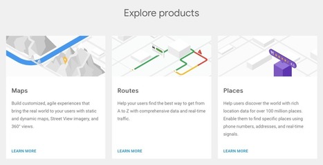
Deck Out Your Route Planning with the New Google Routing API + Eco-Friendly Options

Deck Out Your Route Planning with the New Google Routing API + Eco-Friendly Options | Learning Claris FileMaker | Scoop.it

Fleet managers … raise your hands! 


How many fleet managers do we have in the audience today? 


It’s great to have you all here! 


To make the most of your time as you skim through this article, we’ll skip the chatter and cut to the chase. 


Do you spend every morning manually mapping out routes for your drivers?


...


Read along to see how we can implement Google’s updated Routes API into your Claris FileMaker solution - or build a custom routing software solution for you - to restore time in your day, raise the efficiency and accuracy of your efforts, and...


No comment yet.
Scooped by Didier Daglinckx
Scoop.it!

Google Maps APIs and FileMaker | ISO FileMaker Magazine

Google Maps APIs and FileMaker | ISO FileMaker Magazine | Learning Claris FileMaker | Scoop.it

Unless you've got a billion dollars to send out tens of thousands of cars with specially fitted technology mounted on their roofs; and, you can send them all across the planet, then you'll likely need to rely on mapping data from a third party.

So, here we go with learning how we can leverage Google Maps APIs within FileMaker.

This video will cover the essential knowledge you need in order to make the requests about geolocations whether they be latitude longitude coordinates or an address.


As you've likely used Google Maps within the web browser, it's great to know you can access that same data directly within FileMaker; even the traffic data.

It's just a simple matter of creating the right url. Making a request for what you want, and then parsing the data right back into your FileMaker table.

Let's learn about the process and wire up the technology!

Didier Daglinckx's insight:

You will need a subscription to see the full video.


and btw, it's a good investment if you develop with FileMaker ...


No comment yet.
Scooped by Didier Daglinckx
Scoop.it!

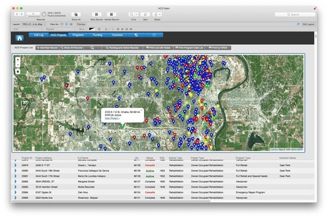
Adds Interactive Maps and GIS Integration to City of Omaha Housing and Community Development FileMaker Solution

Adds Interactive Maps and GIS Integration to City of Omaha Housing and Community Development FileMaker Solution | Learning Claris FileMaker | Scoop.it

The City of Omaha Planning Department Housing and Community Development (HCD) Division uses a FileMaker app as a key technology tool for managing city housing and community development projects.

The app is extensive.

It was built in-house over many years and is highly customized to departmental needs.

It tracks project applications, funding, contacts, vouchers, programs and more.


Read more eon the blog ...

No comment yet.
Scooped by Didier Daglinckx
Scoop.it!

GetDistance - Calculate Distance and Travel Time Using Google Maps API in FileMaker

GetDistance - Calculate Distance and Travel Time Using Google Maps API in FileMaker | Learning Claris FileMaker | Scoop.it

GetDistance is a free FileMaker tool that lets you calculate distances and travel time between two addresses using the Google Maps API.

No comment yet.
Scooped by Didier Daglinckx
Scoop.it!

Geocoding with Open Street Maps and FileMaker | ClickWorks

Geocoding with Open Street Maps and FileMaker | ClickWorks | Learning Claris FileMaker | Scoop.it

Geocoding with Open Street Maps

RETRIEVING LATITUDE AND LONGITUDE


As an alternative for the Google Maps API, you might consider using Open Street Maps (OSM).

OSM has a very simple, clever geocoding service called Nominatim.

No comment yet.
Scooped by Didier Daglinckx
Scoop.it!

FileMaker Maps and GPS Directions in FMSP Contacts | Youtube

FileMaker Maps and GPS Directions in FMSP Contacts

No comment yet.
Scooped by Didier Daglinckx
Scoop.it!

GIS and FileMaker - Mapping and More | Cimbura

GIS and FileMaker - Mapping and More | Cimbura | Learning Claris FileMaker | Scoop.it
FileMaker Devcon 2016’s unconference provided the perfect opportunity for us to speak about Geographic Information Science (GIS)–a subject we’re quite passionate about.


At Cimbura.com we’ve been offering GIS services for some time now ranging from simple webmaps to custom Geographic Information Systems built on FileMaker, WordPress, and other platforms.

The GIS apps we build help customers visualize, question, analyze, and interpret spatial data to better understand relationships, patterns, and trends.

Organizations of all sizes and in almost every industry are using GIS to solve business problems and analyze data with spatial context.


Read more on the blog ...

No comment yet.
Scooped by Didier Daglinckx
Scoop.it!

The Truthful Art: Data, Charts, and Maps for Communication: | Book - FileMaker tool

The Truthful Art: Data, Charts, and Maps for Communication

~ Alberto Cairo (author) More about this product
List Price: $49.99
Price: $44.95
You Save: $5.04 (10%)

No matter what your actual job title, you are—or soon will be—a data worker. 


Every day, at work, home, and school, we are bombarded with vast amounts of free data collected and shared by everyone and everything from our co-workers to our calorie counters.

In this highly anticipated follow-up to The Functional Art—Alberto Cairo’s foundational guide to understanding information graphics and visualization—the respected data visualization professor explains in clear terms how to work with data, discover the stories hidden within, and share those stories with the world in the form of charts, maps, and infographics. 

In The Truthful Art, Cairo transforms elementary principles of data and scientific reasoning into tools that you can use in daily life to interpret data sets and extract stories from them.   


The Truthful Art explains:


• The role infographics and data visualization play in our world

• Basic principles of data and scientific reasoning that anyone can master

• How to become a better critical thinker

• Step-by-step processes that will help you evaluate any data visualization (including your own)

• How to create and use effective charts, graphs, and data maps to explain data to any audience


The Truthful Art is also packed with inspirational and educational real-world examples of data visualizations from such leading publications as The New York TimesThe Wall Street JournalEstado de São Paulo (Brazil), Berliner Morgenpost (Germany), and many more.


No comment yet.
Scooped by Didier Daglinckx
Scoop.it!

FileMaker Google Route Optimization (4'17")

Save time and money by finding the most optimal route to drive to all your appointments. 


We go over how to use the Google Maps Directions API to arrange multiple locations to give you the best route possible.

No comment yet.
Scooped by Didier Daglinckx
Scoop.it!

A Guide To Building SVG Maps From Natural Earth Data | Smashing Magazine - FileMaker tool

A Guide To Building SVG Maps From Natural Earth Data | Smashing Magazine - FileMaker tool | Learning Claris FileMaker | Scoop.it
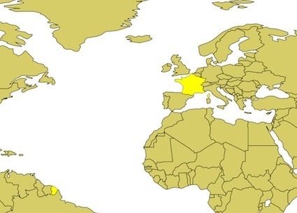
Interactive maps are a fantastic way to present geographic data to your visitors. Libraries like Google Maps and Open Street Maps are a popular choice to do this and they excel at visualizing street-level data. However, for small-scale maps, SVG maps are often a better option. They are lightweight, fully customizable and are not encumbered by any licensing restrictions.
No comment yet.
Scooped by Didier Daglinckx
Scoop.it!

Create A Map Using FileMaker I ZeroBlue

Create A Map Using FileMaker I ZeroBlue | Learning Claris FileMaker | Scoop.it

Today I was asked to create a map using FileMaker to show all the students that are accepted to my client’s school ...

No comment yet.
Scooped by Didier Daglinckx
Scoop.it!

FMEasyMaps | An Open Source Map Solution for the FileMaker Platform

FMEasyMaps | An Open Source Map Solution for the FileMaker Platform | Learning Claris FileMaker | Scoop.it
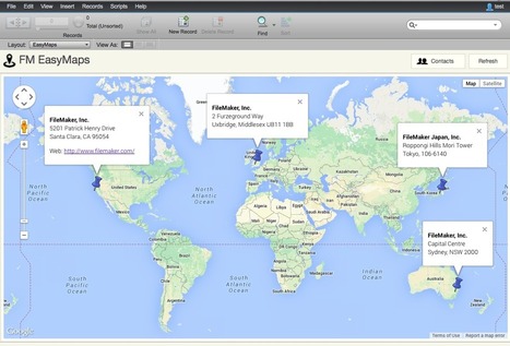
EasyMaps is an open source solution for generating interactive maps based on addresses in FileMaker databases.
No comment yet.