


 Your new post is loading...

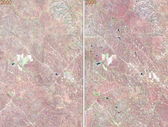

With the help of satellite images fifth and sixth grade students at Mr. Tim Blum’s geography class at the University of Wyoming Lab School got a birds-eye view of how humans have impacted or modified their environments. Images acquired by satellites decades apart showed cleared forests, irrigated crop fields in the middle of the deserts, altered landscapes (new roads and water bodies), and urban growth.
SD: Geospatial technologies can sound daunting for teachers that don't feel that they are specialists. Yet there are simple ways to make sophisticated technologies very relevant to just about any grade level as this article demonstrates.
Via Elpidio I F Filho


great to see 5th & 6th graders learning about environmental impact