Coastal Restoration
26.2K views | +1 today
Coastal Restoration
Coastal management and restoration of our planet's coastlines with a particular focus on California, Louisiana and the Pacific.  Emphasizing wetland restoration, aspects of agriculture in the coastal plain, fisheries, dealing with coastal hazards, and effective governance.
Curated by PIRatE Lab
Your new post is loading...
Scooped by Hunter Santana
Scoop.it!

Southern California Rain is worsening Rancho Palos Verdes landslides –

Southern California Rain is worsening Rancho Palos Verdes landslides – | Coastal Restoration | Scoop.it
Some residents of the Seaview neighborhood of Rancho Palos Verdes, a quiet community with stunning ocean views, are getting used to a new normal: Water pipes that were dug up to be place over the ground, sandbags in many corners of the area, and plastic tarps covering acres of oceanfront land. Ground movement in the Portuguese Bend areas where the…
Hunter Santana's insight:
Citizens of the Rancho Palos Verdes area have become victim to landslides due to the recent rains. The landslides have eroded "several hundred acres." Damage control crews are attempting to restore the area and reconnect water lines that have been broken in the landslide. The city has officially declared a state of emergency.
Olivia Moorehead's comment, February 23, 11:50 AM
There are many areas within California facing challenges from the storms, but this article really captures the challenges faced within Rancho Palos Verdes, and the sort of challenges that come with evacuation protocols and the urgency of the situation.
Scooped by PIRatE Lab
Scoop.it!

Don't hydroseed with Ryegrass!

Don't hydroseed with Ryegrass! | Coastal Restoration | Scoop.it
VCStar.com is the home page of Ventura County, California, with in-depth and updated local news, sports, things to do, investigative journalism and opinions.
PIRatE Lab's insight:
The brief, hard rain two weeks ago caused calamities to the north, but local hillsides are now sprouting hopeful shoots of green. You may be tempted to help nature’s process by spreading seeds on hillsides stripped bare of vegetation, but erosion, flooding, fire danger and weed removal are the possible consequences.

According to the California Native Plant Society and Channel Islands Restoration, past efforts to quickly spread non-native seeds on denuded hillsides appeared successful in the short term, but caused more problems than they solved. People used to plant ryegrass, which grows rapidly with little water. However, “after agencies called it a success and moved on to the next project, it would dry out ... resulting in greater fuel for fires,” according to the two nonprofits. Worse, these non-natives displaced perennial bunchgrasses, which send down deeper roots and are therefore more resistant to drought. 

The good news is that our hillsides — at least the ones left in a natural state — usually store seed banks of native grasses that respond quickly to fire. Dense, old-growth chaparral burns quickly in fires, opening space for seeds in the soil to sprout. 

Roots and stumps can also sprout, and acorns may germinate and grow with less competition and better access to soil nutrients. Eventually, “a complex interweaving of different root types can stabilize the soil better than any artificial seeding mix that could be devised,” according to the groups. For erosion control on more developed landscapes, these experts recommend wattles, such as straw-stuffed tubes of netting, and biodegradable mats made from material such as coconut fiber or jute. Choose a wide weave so plants can sprout through it.
No comment yet.
Scooped by PIRatE Lab
Scoop.it!

On unstable ground: Engineers and road workers fight Mother Nature while trying to fix Highway 1

On unstable ground: Engineers and road workers fight Mother Nature while trying to fix Highway 1 | Coastal Restoration | Scoop.it
Caltrans’ ambitious one-year, $40-million repair job for Highway 1 at Mud Creek attempts to repair the largest landslide to hit the California coast
PIRatE Lab's insight:
We'll be here in a couple of weeks!
No comment yet.
Scooped by PIRatE Lab
Scoop.it!

Henderson Property Eroding Into Bayou

Henderson Property Eroding Into Bayou | Coastal Restoration | Scoop.it
A property in Henderson is eroding into bayou.
PIRatE Lab's insight:
Wow!  Talk about lack of objective reporting!  He says, she says...the job of reporters it to help the public understand the issues and filter out the fluff.
No comment yet.
Scooped by PIRatE Lab
Scoop.it!

Storm to bring more rain, but less intense

Storm to bring more rain, but less intense | Coastal Restoration | Scoop.it
With more rain headed to the county, officials said Monday that a stretch of the Pacific Coast Highway closed since Friday's storm probably won't reopen for three to four weeks.


The closure runs from Las Posas Road in Camarillo to Yerba Buena Road near Malibu. Mud and debris slid across the highway in several spots, pushing concrete barriers 70 feet across the road. 

Debris must be cleared and hauled out of the area, and several shoulder sections also must be repaired, officials said.

PIRatE Lab's insight:

Wow.  The impacts to PCH were much more severe than I was led to believe.  Yet another coastal management challenge; all of this stemmed from the 2013 Camarillo Springs Fire and subsequent drought which has kept this region revegetated for ~2 years.


See also:

http://www.latimes.com/local/lanow/la-me-ln-portion-of-pch-to-be-closed-20141215-story.html


http://www.latimes.com/local/lanow/la-me-ln-near-death-experience-on-pch-20141212-story.html


No comment yet.
Scooped by PIRatE Lab
Scoop.it!

Coastal Sediment Management Workgroup

Please join the California Coastal Sediment Management Workgroup co-chaired by the U.S. Army Corps of Engineers and California National Resources Agency for the California Coastal Sediment Master Plan, Outreach and Plan Formulation Stakeholder Meeting 2.  The meeting will be held on Thursday, July 31, 2014 from 9:00 am to 12:00 pm at the San Diego Association of Governments (SANDAG) office (8th Floor Board Room) located at 401 B Street in San Diego, California.  

The overall purpose of the meeting is to obtain input from coastal stakeholders regarding how best to pull together existing regional sediment management plans into a state-wide sediment master plan.  Please note that lunch will not be provided so plan accordingly. Please RSVP to David Cannon at david.cannon@everestconsultants.com by Friday, July 25. More information about the California Coastal Sediment Master Plan is available online. 

No comment yet.
Scooped by PIRatE Lab
Scoop.it!

CSUCI Earns NSF Grant to Study Wildfire Effects

A new grant from the National Science Foundation (NSF) will help CSU Channel Islands (CSUCI) students study the effects of wildfire on the area’s ecosystem.  The grant funds a collaborative research partnership between CI, UC Santa Barbara and University of Colorado Denver to systematically examine the impacts of wildfire on chaparral and watersheds. 

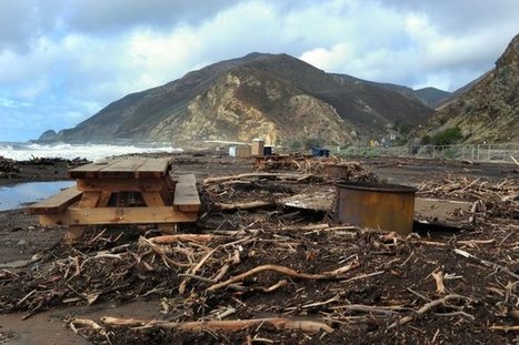
Linda O’Hirok, a lecturer in CSUCI’s Environmental Science & Resource Management program, is leading six students in the project this semester.  A main focus of their investigation is Big Sycamore Canyon, which burned during the May 2013 Springs Fire that scorched 24,000 acres and threatened the CSUCI campus.  They’re comparing the resilience of the recently-burned landscape with three similar sites in the region: a tributary of Matilija Creek that burned during the July 1985 Wheeler Fire, a tributary of Malibu Creek that burned in 1993, and an unburned tributary in Wildwood Canyon. 

“The growing danger of wildfires has increased our need to understand the way watersheds respond,” said O’Hirok. “By studying and measuring the post-fire runoff and erosion at four different sites in four different stages of recovery, we can piece together a compelling story of the short- and long-term effects of wildfire in chaparral environments.  This could help us better predict dangers from erosion and flooding after wildfire and guide emergency planning.”

PIRatE Lab's insight:

Great work here by my colleage Linda O'Hiok.  This highlights the value of long-term, often under- or non-funded, "unsexy" monitoring work. The decades-long monitoring of the geomorphology of this coastal stream is poised to help us better predict how and when coastal watershed will mobilize debris post burn...as soon as our winter starts...any day now...I hope!

No comment yet.
Scooped by PIRatE Lab
Scoop.it!

Calamity Calling: Imagine a world without beaches

Vimeo is the home for high-quality videos and the people who love them.
PIRatE Lab's insight:

Good visuals.

No comment yet.
Scooped by Tess Davidson-Henney
Scoop.it!

Victoria's changing coastline monitored by sky-high volunteers in citizen scientist initiative

Victoria's changing coastline monitored by sky-high volunteers in citizen scientist initiative | Coastal Restoration | Scoop.it
Volunteers in coastal communities have been trained to pilot lightweight drones mounted with cameras in order to precisely measure shoreline change along Victoria’s coastline.
Jennifer Torres's comment, October 13, 2020 8:13 PM
Always nice when the community volunteers their time to take care of their environment.
Scooped by PIRatE Lab
Scoop.it!

No Doubting Thomas - YouTube

No comment yet.
Scooped by PIRatE Lab
Scoop.it!

Before and After Photos: SE Beach Dunes Lost to Hurricane Matthew

Before and After Photos: SE Beach Dunes Lost to Hurricane Matthew | Coastal Restoration | Scoop.it
Hurricane Matthew’s storm surge and waves overwashed about 15 percent of the sand dunes on Florida's Atlantic coast, 30 percent along Georgia’s coastline, and 42 percent of dunes on South Carolina’s sandy beaches as the powerful storm brushed past the Southeastern states October 6-9, according to USGS experts' preliminary review of USGS low-altitude before-and-after images along of the coast and NOAA photographs collected after the storm.
PIRatE Lab's insight:
A great example of pulsed loss of coastal elements: in this case sandy beach and dune communities.  Additional imagery is available here: http://coastal.er.usgs.gov/hurricanes/matthew/photo-comparisons/florida.php

See also stories in the Miami Herald: 


And NPR's Morning Edition:

No comment yet.
Scooped by PIRatE Lab
Scoop.it!

Scientists see a future of El Niño-fueled coastal erosion

Scientists see a future of El Niño-fueled coastal erosion | Coastal Restoration | Scoop.it
The seacoasts of California and nations on both sides of the Pacific are likely to be battered in coming years by increasingly high waves pushed ashore by ever-stronger weather patterns, leaving them vulnerable to destructive erosion, an international group of experts said Monday. Severe weather events across the entire Pacific basin have been increasing for more than 30 years, and are expected to double in frequency in coming years, the scientists said in a report published in the journal Natu
No comment yet.
Scooped by PIRatE Lab
Scoop.it!

Louisiana's trespass laws lock anglers out of most coastal marshes

Louisiana's trespass laws lock anglers out of most coastal marshes | Coastal Restoration | Scoop.it
Louisiana is known as the Sportsman's Paradise, and its a moniker that's well-deserved. Natives have heard all their lives about unfettered coastal subsidence that gobbles our marshes, turning them from fish nurseries and bird rookeries into vast, open-water nothingness. That...
PIRatE Lab's insight:

A great piece highlighting the challenges of delineating private property along a dynamic, eroding shore.  When we are in Louisiana and on the water we use 1950's-era maps; so much wetland has converted to open water trying to silly navigate straight ahead is likely to get your boat stuck/prop bent on the bottom  two feet below the surface.  This story points up one of the many challenges to having the coastal zone be private and defining the resources that are on (or swimming over) them private.  It is especially humorous that we need to reference 200 year old maps of a coastline that is eroding faster than almost anywhere else on the planet.


See the state "helper" mapping tool, that I am sure every angler and kayaker consults as they are navigating to their favorite spot:


http://sonris-www.dnr.state.la.us/gis/agsweb/IE/JSViewer/index.html?TemplateID=381

No comment yet.
Scooped by PIRatE Lab
Scoop.it!

Logging and Mudslides

Logging and Mudslides | Coastal Restoration | Scoop.it
In recent decades the state allowed logging — with restrictions — on the plateau above the Snohomish County hillside that collapsed in last weekend’s deadly mudslide.
PIRatE Lab's insight:

There are several reasons for mudslides--some are purely a result of physical geography and others are related to land use patterns.  This last week's mudslide in Washington state was a combination of the two and although this impacts one place (see on map), it is a good teaching moment to discuss the environmental impacts of land use patterns and resource extraction projects.  As seen in this interactive, the river was cutting at the base of the hill, while loggers were clear-cutting at the top of the mountain.  Trees help prevent erosion as the roots hold the soil in place--a critical piece to the puzzle in a very rainy climate.  With $1 million worth of timber on the slope, logging companies persisted despite objections from the Department of Natural Resources and some restrictions (but in hindsight, those restrictions clearly were not enough). 


View the impact in ArcGIS online: Before and After Swipe, LiDAR I and II, and Imagery.


Questions to Consider: Other than economic worth, what other ways are there to value and evaluate the environment?  How could this landscape have been protected and managed better or was this mudslide inevitable?   

Sally Egan's curator insight, April 2, 2014 10:10 PM

Intersting relevance to Ecosystems at Risk and human activities which impact on ecosystems.

Geofreak's curator insight, April 3, 2014 1:39 PM

Mijnbouw en aardverschuivingen, een goede combinatie ...... 

El Futuro deWaukesha's curator insight, April 18, 2014 12:03 AM

Working on an Inquiry of recent natural disasters with first grader.  

Scooped by PIRatE Lab
Scoop.it!

County Starts Beach Renourishment and Groin Construction Projects in Florida

From Longboat Key north to Holmes Beach, the shore has been wrestling with storms and tidal surges, challenging both property owners and vacationers.


At Monday's Tourist Development Council meeting in Holmes Beach, Manatee County Parks and Natural Resource Department Director Charlie Hunsicker delivered an update on the beach renourishment project about to start on Anna Maria Island. If all goes as planned, they will be renourished by May of next year.


The sand comes from 4,000 feet down, deep off of the gulf floor, through pipes that carry it onto the shore. The vessels doing the work can pump the slurry from as far as nine miles out from shore to replace eroded sand. 


Hunsicker said the project will cost $16 million; $10 million from the Federal Government and $6 million more from state and local taxes. 

PIRatE Lab's insight:

Hmmmm....permeable groins, eh?  It will be interesting to see how these might work in Florida.

No comment yet.