


 Your new post is loading...

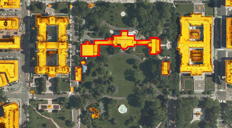

Have you ever wondered what the solar potential of your home is? Or where you work? Or the White House maybe?
A new interactive map commissioned by the District Department of the Environment and created by Mapdwell allows users to click on almost any building in the city and see "how much electricity can be produced on their rooftops from solar photovoltaic (PV) systems, how the financial investment will pay off, and how much pollution will be reduced." You can also see where solar systems are already installed and what the yearly financial benefit is.
The data used to create the map comes from the Army's Light Detection and Ranging (Lidar) system, aerial imagery from the D.C. Geographic Information System and building footprints from EarthData International, Inc. Mapdwell is "a collaborative effort by researchers, academics, and professionals at MIT."
Via Lauren Moss


Potentiel solaire de nos toits