Your new post is loading...
This is the story of how Google Search died, and the people responsible for killing it.
The story begins on February 5th 2019, when Ben Gomes, Google’s head of search, had a problem. Jerry Dischler, then the VP and General Manager of Ads at Google, and Shiv Venkataraman, then
The benefits of buying space companies to pursue vertical integration are becoming less apparent in the current economic climate.
SpaceX celebrates the satellite business as a money-making venture fueling a quest to launch rockets and reach Mars.
SpaceX's move into EO could present a big challenge to companies selling space data already.
A Ukrainian military source believes that Russia’s long-range strikes are aimed using satellite imagery provided by U.S. companies.
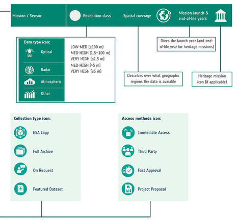
ESA’s latest Third Party Missions Data Access Guide has been published, providing technical details and information on available data collections for all current or past Third Party Missions.
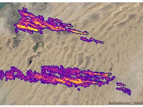
MethaneSAT will circle the Earth 15 times a day, identifying emission sources and their rates
Researchers from Wuhan University say they gave the technology full control of a satellite and set it free for 24 hours.
Depuis 2021, le modèle d’IA LightningCast s’est avéré être un outil efficace pour aider les scientifiques à prévoir les incendies de forêt.
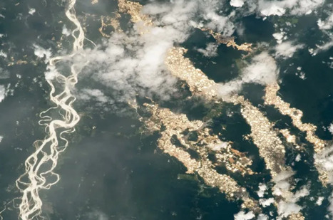
In the Madre de Dios region of Peru, a human-made wasteland brushes up against the border of the Amazonian rainforest. Over the past decade, small-scale illegal gold miners have transformed the landscape from tree-covered marshlands to a desert pockmarked with polluted ponds, leaking mercury into the local food web.
Satellites are playing a growing role in identifying methane sources as the international community focuses on curbing emissions.
Si la population toulousaine croît chaque année, ce n’est pas un hasard car en plus d’une qualité de vie recherchée.
|
A newly energized Russia is already escalating grey-zone operations in Eastern Europe, says Estonia’s defense minister.
The origins of geospatial intelligence (GEOINT) can be traced back to the early days of aerial photography and reconnaissance during World War I and World War II. Military leaders recognized the immense value of capturing images of enemy positions, fortifications, and troop movements from the air. This visual intelligence provided a significant tactical advantage on…
La France est une nation maritime. La stabilité de son économie nationale, de son commerce et de sa sécurité est intrinsèquement liée à la nature maritime du commerce international.
The National Labor Relations Board alleges that SpaceX "interfered with, restrained and coerced its employees"
Operators are developing creative solutions for putting AI on satellites, a challenge that comes with myriad technical and logistical obstacles.
In the ever-evolving landscape of intelligence gathering, satellite imagery has emerged as a pivotal tool in the realm of open source intelligence (OSINT). As technology advances and access to high-resolution satellite data becomes more widespread, the role of satellite imagery in OSINT continues to expand, revolutionizing the way intelligence is collected, analyzed, and disseminated.
No, it probably won't involve a battle between X-wings and TIE fighters
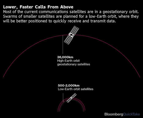
New satellites that orbit the Earth at very low altitudes may result in a world where nothing is really off limits.
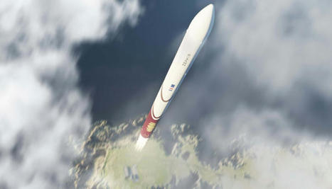
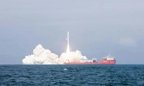
China launches 20 satellites on separate inland and sea rocket launches A pair of Chinese rockets launched 11 mobility services satellites for an automaker and nine further, diverse satellites into orbit late Friday.
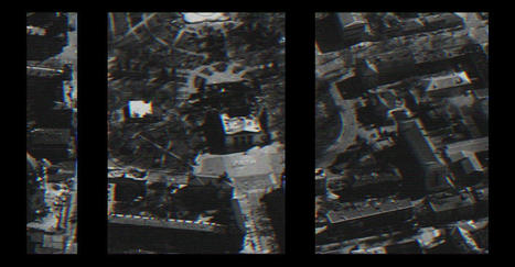
Pour renouveler ses capacités d’observation spatiale, le Royaume aurait misé sur un satellite nouvelle génération OptSat-3000 de fabrication israélienne. Si le nouveau satellite possède des instruments plus précis, ce sont surtout le coût et la promesse de transfert technologique qu
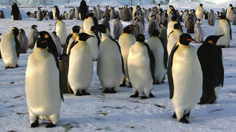
Researchers have recently identified four new emperor penguin colonies nestled amongst the vast Antarctic expanse in a ray of hope.
|


![Renseignement spatial : Que vaut le futur satellite espion du Maroc ? [INTÉGRAL] | NewSpace | Scoop.it](https://img.scoop.it/bQsKXuf3AgjD8s6EBLw7gjl72eJkfbmt4t8yenImKBVvK0kTmF0xjctABnaLJIm9)